Related posts;
For some years now I’ve harboured an interest in the Bicentennial National Trail (BNT), in particular as a mountain bike route. I hasten to add that this post and future posts will not detail a complete traverse of the 5330km of the Trail rather; I hope to explore, in no particular order, the sections between Blackbutt and Killarney and some sections of the Trail extending south from Killarney. These sections of the Trail and the route across them are detailed in the official Guidebooks numbered 6 and 7.
The Bicentennial National Trail, to my mind at least, has always been a bit of a mystery. A green squiggly line on some maps stretching from Cooktown (North Queensland) to Healesville (Victoria) hearsay suggests that the trail is constantly being re-routed as Mother Nature and land access issues dictate. The web, usually a, reliable source of information with regards to route-planning is stubbornly silent for the most part on the matter. The Guidebooks, which require membership to purchase, are not inexpensive and getting on in print years although updates are posted on the Trails website. Additionally, promotion of the Trail still appears to be targeted primarily towards equestrian access, (its original intended purpose and formerly known as the National Horse Trail) although it is now classed as a multi-use trail suitable for both trekkers and cyclists. For these reasons, and probably many more, I sense that the Trail, particularly in the South Eastern Corner of Queensland is underutilised from a mountain biking perspective. More so, if the rise in popularity of Bike-packing is taken into account.
Guidebook 6 of the Bicentennial National Trail (now out of print and available only in draft form and, as an ‘e-guide’) covers the Blackbutt to Killarney section. According to the Guidebook, none of this sections ~357kms' are particularly difficult for the cyclist. The route mostly follows the foothills of the Great Dividing Range passing just to the east of Toowoomba however, the range must be climbed just south of Toowoomba and again near the border. The Trail passes through a mixture of rough bushland and settled grazing/agricultural areas and makes use of the Brisbane Valley Rail Trail as it leaves Blackbutt. It is worth mentioning that significant sections of the Trail in this region were destroyed in the 2011 and 2013 floods. As a result, there has been some major re-routing of the trail to deal not only with flood damage but also land access issues. Thus, Guidebook 6 is available only in draft form at the present time. Despite this, the Guidebook is complete in that it provides maps and route notes for the entire section.
Guidebook 7 of the Bicentennial National Trail traverses rugged and remote country just east of the Great Dividing Range, following the Demon Fault. Stretching from Killarney to Ebor, this section of the Trail is approximately 370km in length and provides a great variety of scenery and gives access to several National Parks including Bald Rock and Gibraltar Range. According to the Guidebook, this section is excellent for mountain biking although the route includes some steep climbs and a few water crossings that may prove problematic for cyclists. The latest edition of Guidebook 7 was published in 2007 however; the Trails website offers up-to-date information with regards to re-routing resulting from land access issues or trail damage.
Guidebook 7 Map 1; Killarney to Cullendore Border Gate (~28km)
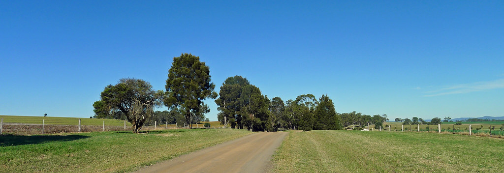
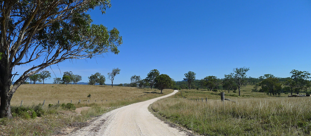
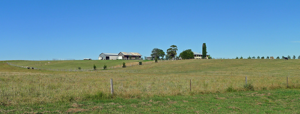
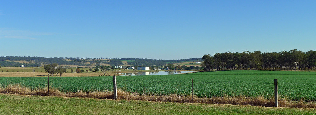
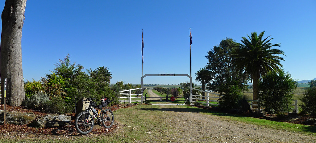
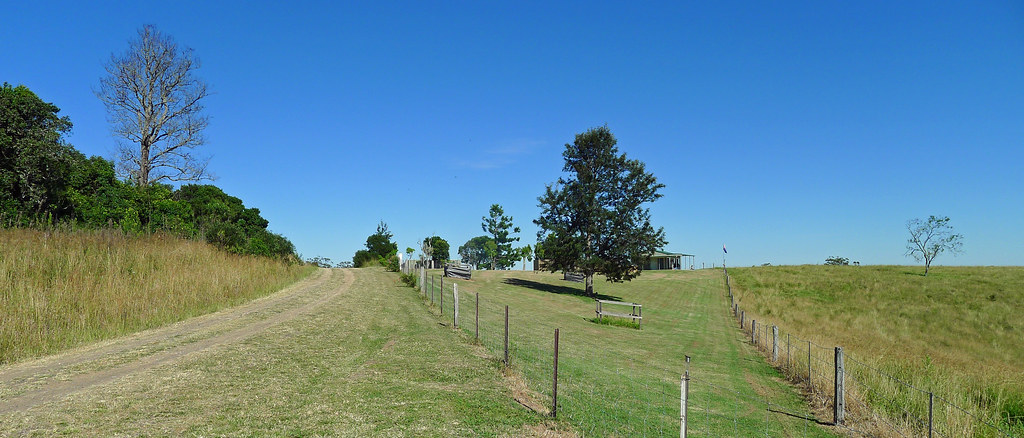
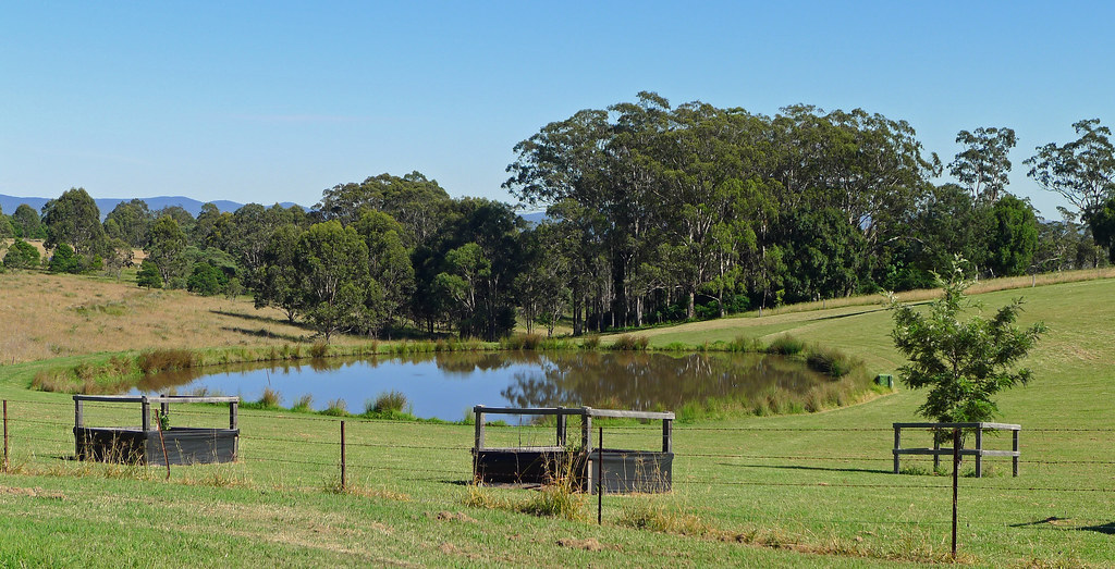
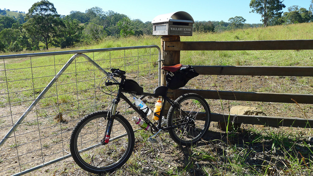
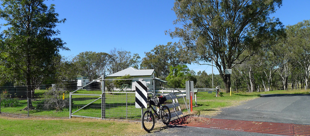
Killarney, nestled in the Border Ranges between Queensland and New South Wales and situated at the foothills of the Great Dividing Range, is the staging point for this section of the BNT. From the Killarney Showgrounds the route winds its way out of Killarney in a general south-westerly direction along quiet rural roads and beside extensive agricultural and livestock properties. Along the way, the Trail offers expansive views into New South Wales and just south of Killarney the States Dingo Proof Fence is encountered. This is a relatively small part of a barrier which extends for 5614km, right across southern Queensland and into South Australia. The Trail to the QLD/NSW border is easy riding and the Queensland and New South Wales State border fence is reached after about 13km of travelling. Here, the old Barlows Gate Borderhouse, now a private residence, signals the end of the ‘on road’ section. From this point onwards, the QLD/NSW Border Rabbit Fence, and specifically the track used to maintain the fence, is followed along the Queensland side of the border until the Cullendore Border Gatehouse, which sits perched on the edge of the Granite Belt, is reached some 15km later.
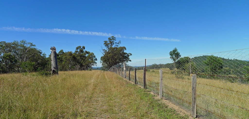
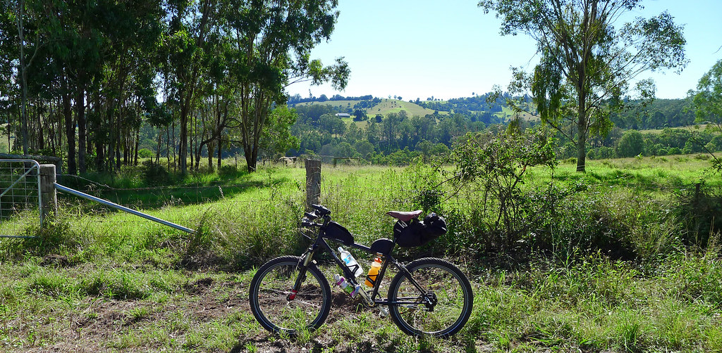
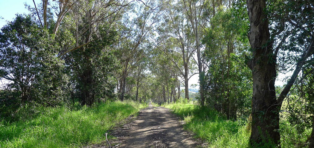
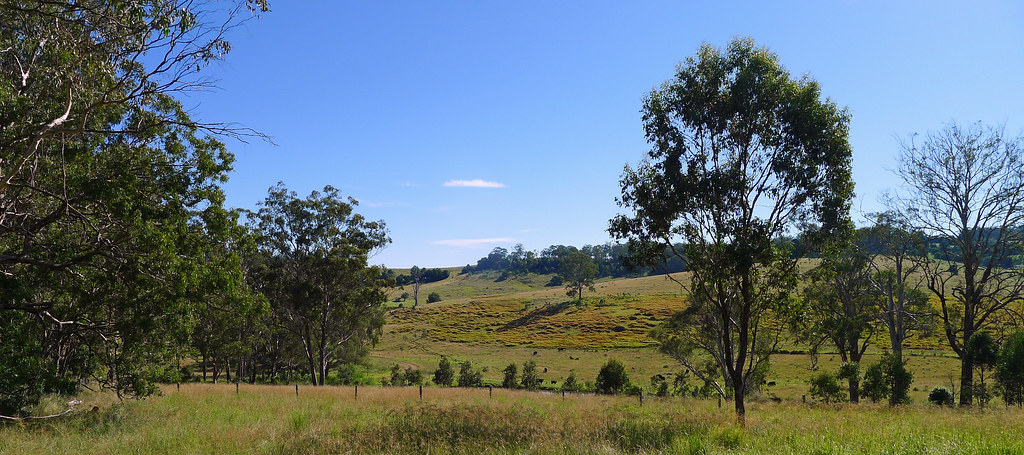
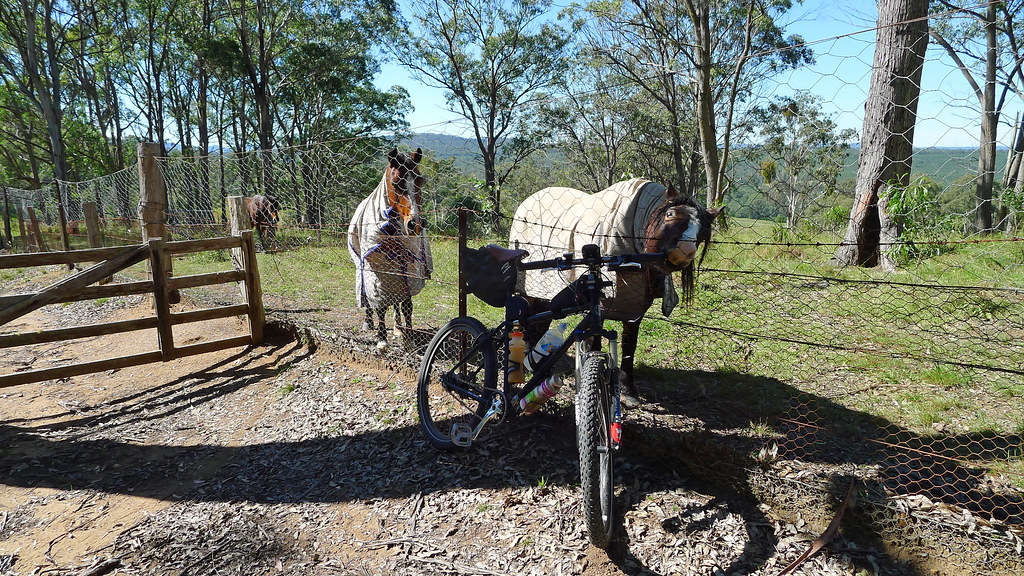
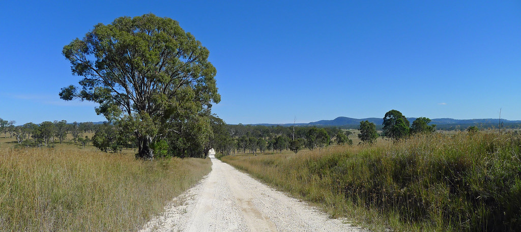
The Trail along the border fence is undulating on a mixture of smooth and rough tracks that, at times, are heavily littered with tree debris (‘derailleur destroyers’). The sections of the track that are more exposed and at higher elevations are prone to grass cover that can reach mid-thigh high. Having forgotten my gaiters, my legs were feeling particularly exposed in these sections and I was always keen to see the emergence of some resemblance of a dirt trail. Don’t be overly fooled by the accompanying photographs because while this section of the Trail may not be geographically remote, civilisation, at times, is relatively far removed. It is not a section, when riding alone, for any incident, such as snake bite or accident as “help” may not pass by any time soon. Having said that, there is nothing that is difficult or, unrideable along this stretch of the Trail however, riding with a companion or taking adequate precautions, if going solo, will eliminate any perceived “obstacles”. Navigating this section of the Trail is simple; keep the border fence on your left hand side with one exception. Before leaving on this ride I had failed to check the Trails website for route updates and came across a section of the Trail that not only had a BNT marker pointing in a direction that did not correspond to my map but was also signed as private property and no trespassers. Presuming this was the work of a disgruntled land owner and that I still had legal access I continued. Later, checking the Trails website it was apparent that this section of the Trail has now been officially closed and a bypass has been established. Traveling north to south, at ~23.80km a right turn is now required onto the newly constructed St Hellens Road. This in turn, will bring you back to the border fence and is only ~2km longer than the orginal Trail route. Full details here; http://www.bicentennialnationaltrail.com.au/wp-content/uploads/2013/03/Guidebook-7-update.pdf
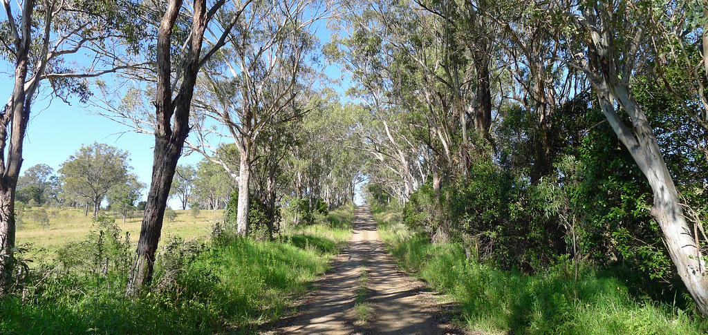

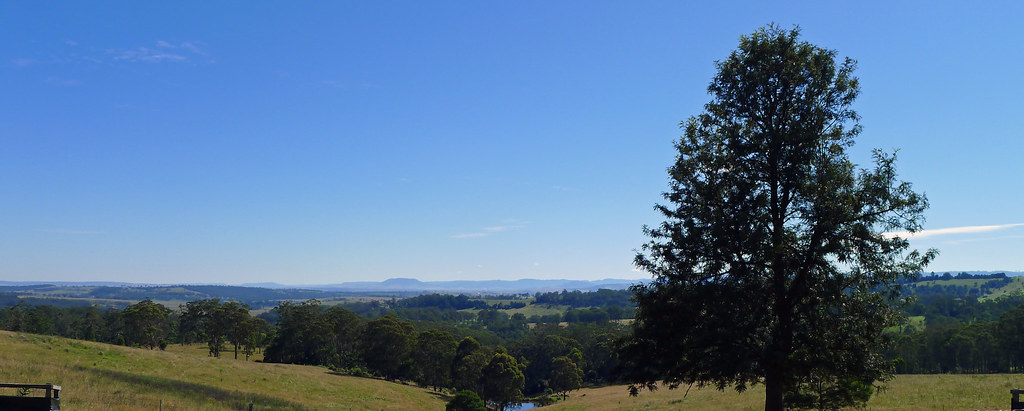
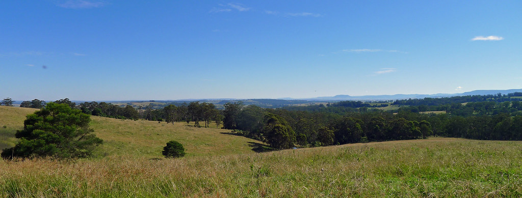
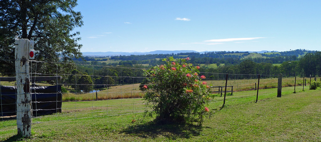
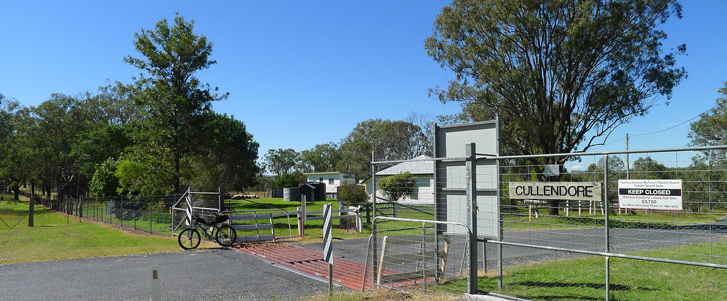
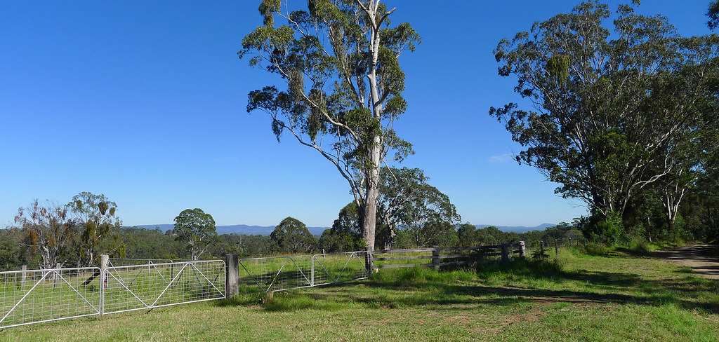
In general, the scenery is more attractive and expansive along the ‘road’ route to the New South Wales Border/Rabbit Fence. Once the Border/Rabbit Fence is reached, and the dirt road ends, the BNT narrows to a vague maintenance track and the bush crowds in limiting the views. However, when higher elevations are obtained, the bush opens up and the views over the border into NSW are stunning. In nearly ten years of exploring this region I don’t think I have ever seen the countryside so lush and green. This segment of the BNT ends at the Cullendore Gate on Cullendore Road. A minor road it crosses the Great Dividing Range almost due south of Warwick at an altitude of just under 600 metres. The rabbit-proof fence is incorporated in the Border Gate and the road crossing is over a cattle grid. In years past, when the gatehouse was manned, (not presently I presume) cattle crossed the border through a separate gate and were held in a holding pen in front of the gatehouse hut while awaiting tick inspection. Now, the whole inspection, treatment or permit process is managed by appointment only.
Those interested (like myself) in a loop ride returning to Killarney have numerous options. It is possible to return to Killarney in a general north-easterly direction, through the Elbow Valley, via a mixture of quiet rural dirt and bitumen roads. An error in navigation saw me deposited 10km outside of Killarney on the main Warwick-Killarney Road. For the most part this road has a narrow shoulder and the traffic was roughly one car per kilometre but I have a distinct dislike for highway riding and cursed my mistake. Regardless of the return route to Killarney the result will be roughly a 60km circuit. I wouldn’t try this ride in or shortly after wet weather as some sections, admittedly short, would be horrendous due to the sticky nature of the mud in this region. Nor would I consider riding this route in the middle of summer as the exposed sections, away from the shade of the trees, would be sweltering. An easy to moderately difficult ride, depending on one’s ability to ride 60km mostly off road. All up, an interesting, scenic ride with a couple of historical landmarks thrown in for good measure.
Tracklog 1) http://en.wikiloc.com/wikiloc/view.do?id=4421447
Tracklog 2) http://en.wikiloc.com/wikiloc/view.do?id=4421458
Guidebook Update http://www.bicentennialnationaltrail.com.au/wp-content/uploads/2013/03/Guidebook-7-update.pdf