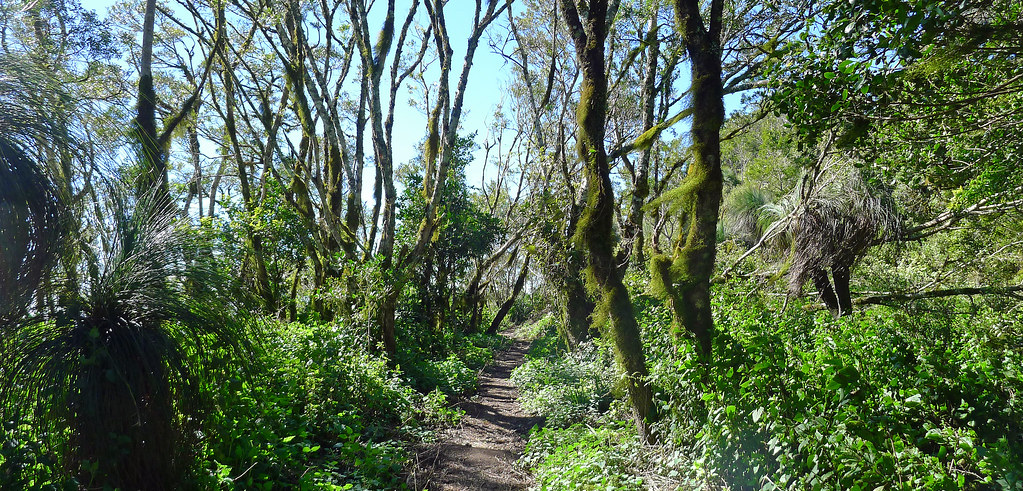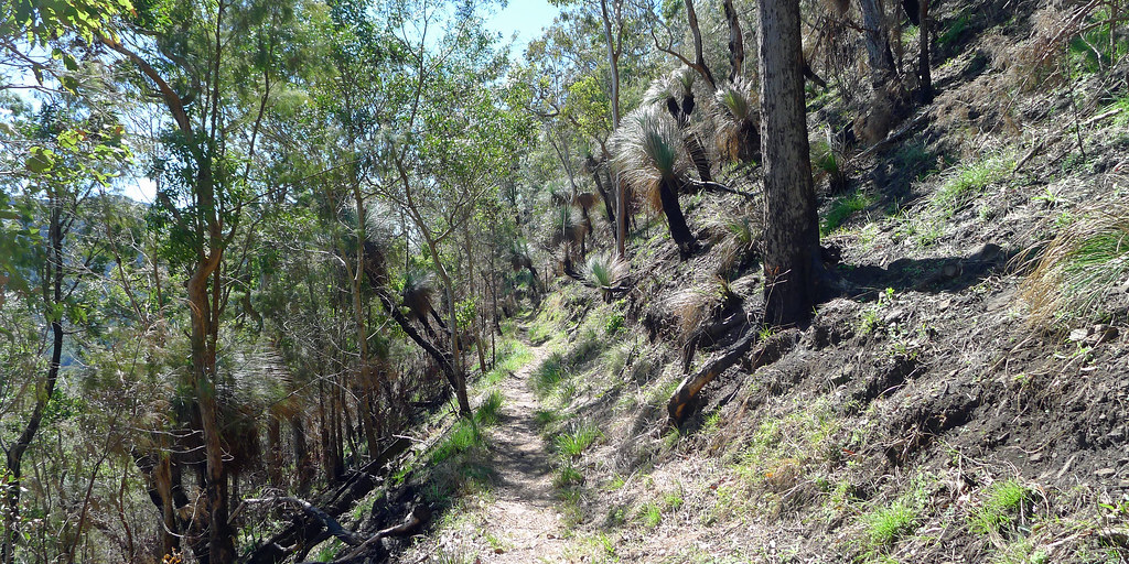
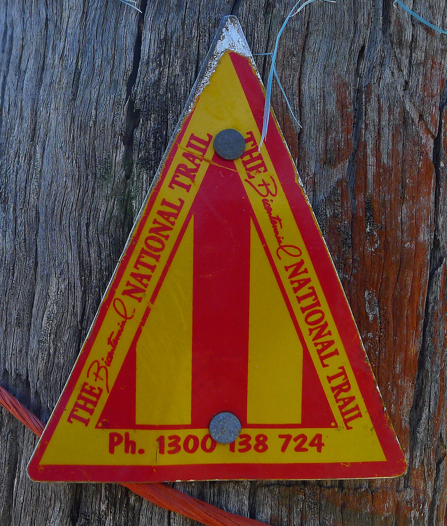
Guidebook 6 of the Bicentennial National Trail (now out of print and available only in draft form and, as an ‘e-guide’) covers the Blackbutt to Killarney section. According to the Guidebook, none of this sections ~357kms' are particularly difficult for the cyclist. The route mostly follows the foothills of the Great Dividing Range passing just to the east of Toowoomba however, the range must be climbed just south of Toowoomba and again near the border. The Trail passes through a mixture of rough bushland and settled grazing/agricultural areas and makes use of the Brisbane Valley Rail Trail as it leaves Blackbutt. It is worth mentioning that significant sections of the Trail in this region were destroyed in the 2011 and 2013 floods. As a result, there has been some major re-routing of the trail to deal not only with flood damage but also land access issues. Thus, Guidebook 6 is available only in draft form at the present time. Despite this, the Guidebook is complete in that it provides maps and route notes for the entire section
Follow up post to; http://thenorrisfiles.blogspot.com.au/2013/08/bicentennial-national-trail-thornton-to.html
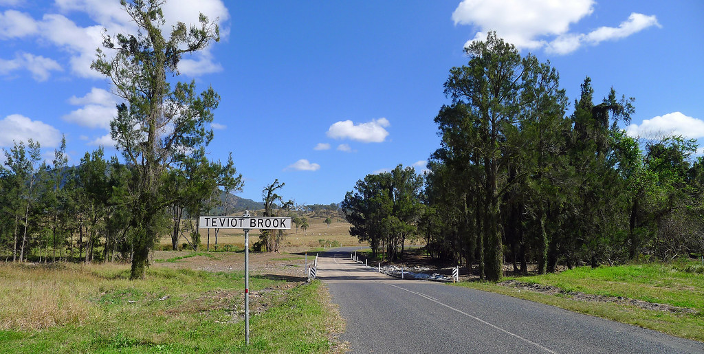
Guidebook 6 Map 14; Rosevale to Allan Cunninghams Historical Campsite (~21km)
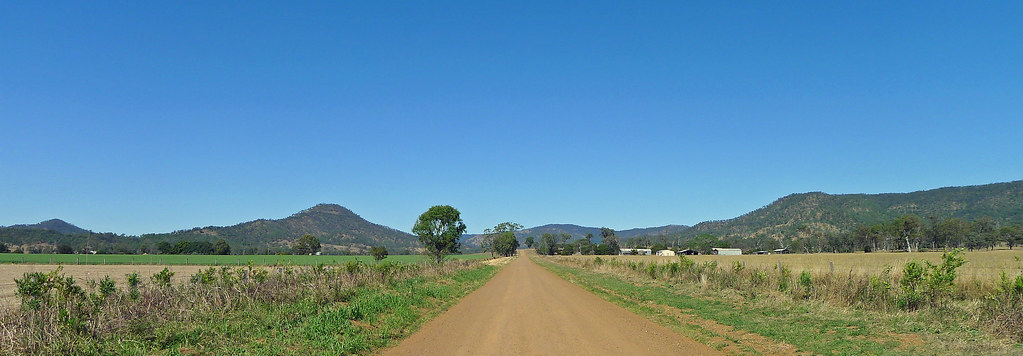
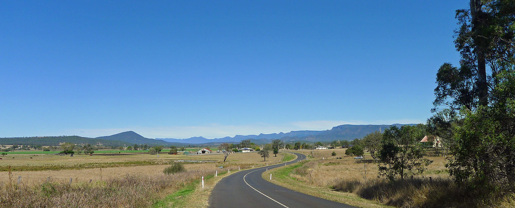
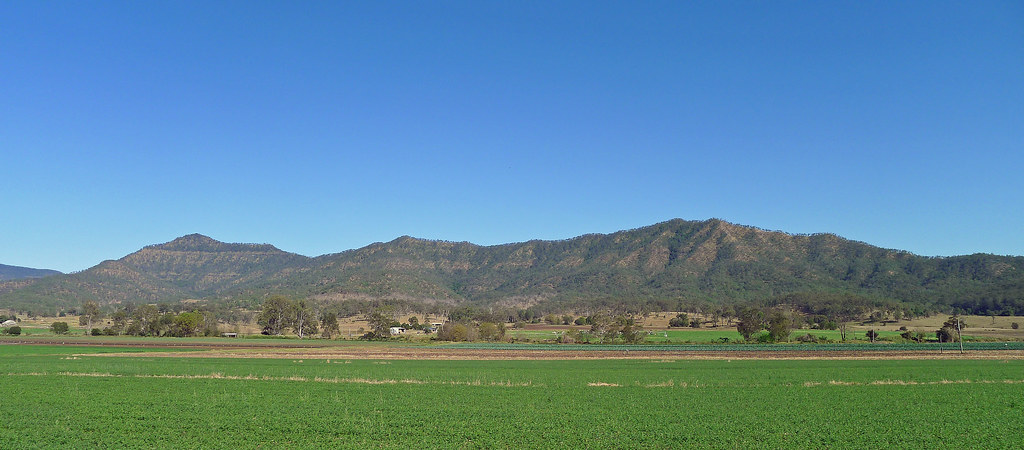
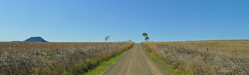
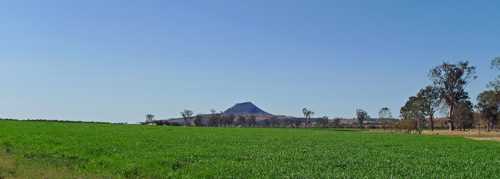
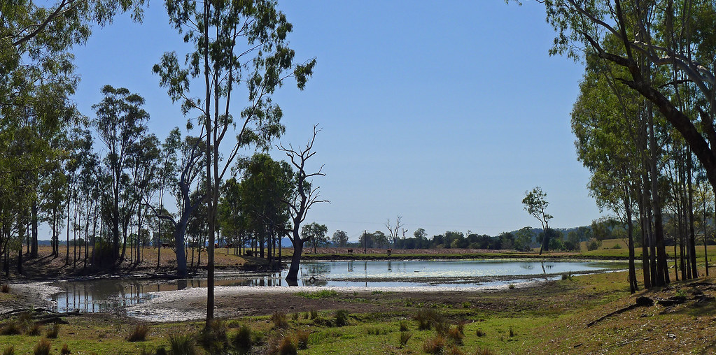
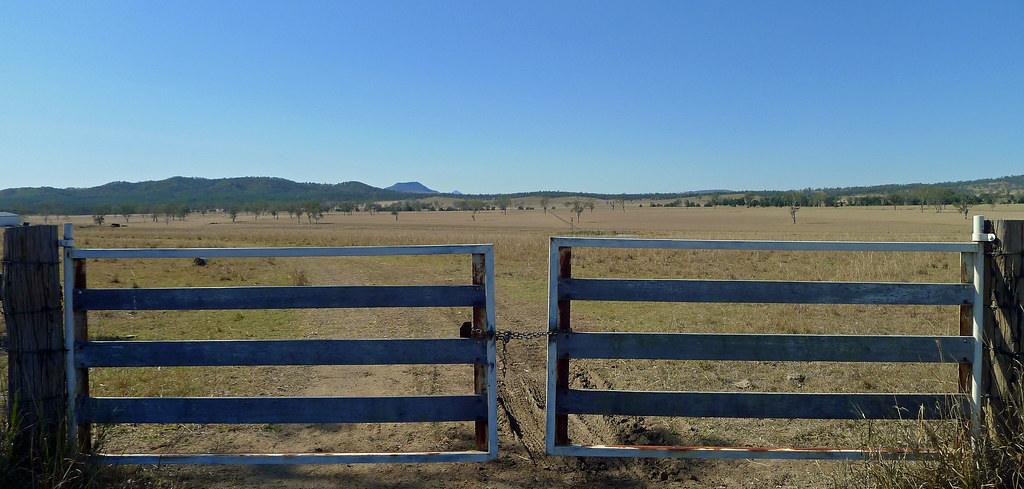
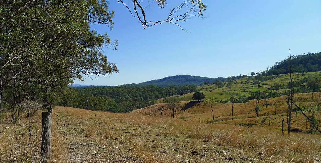
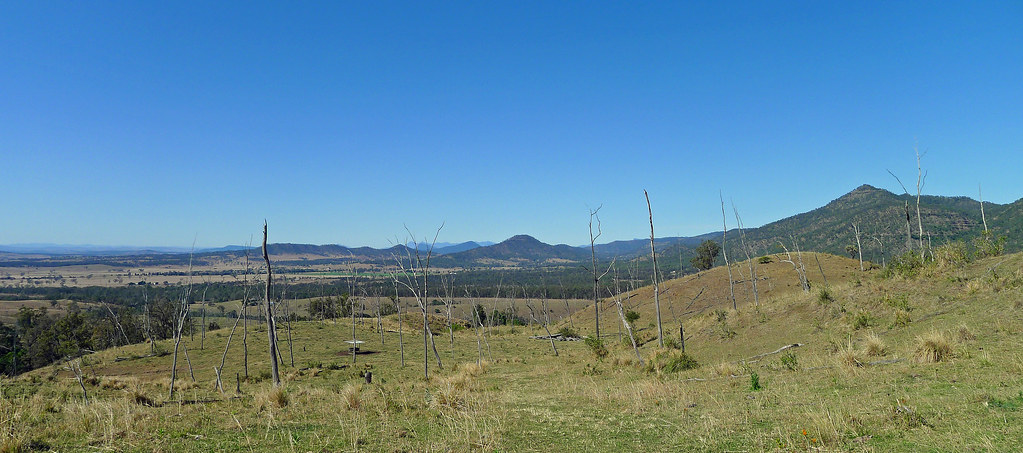
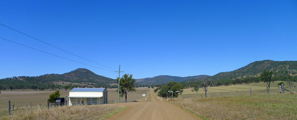
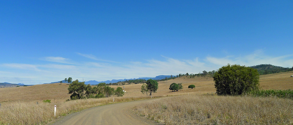
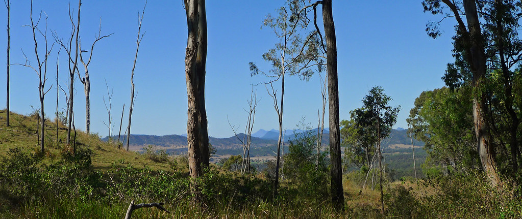
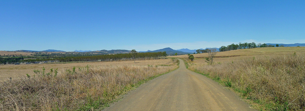
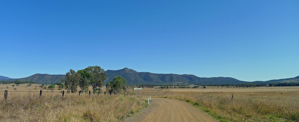
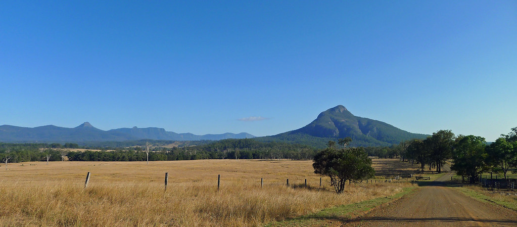
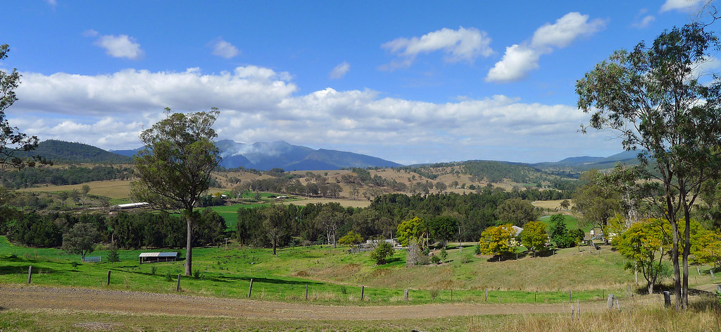
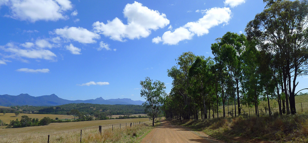
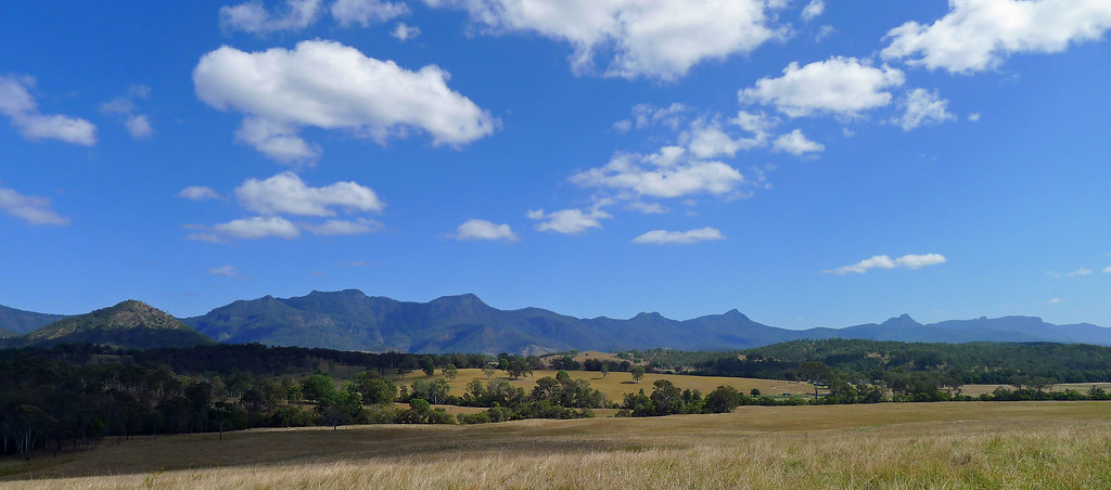
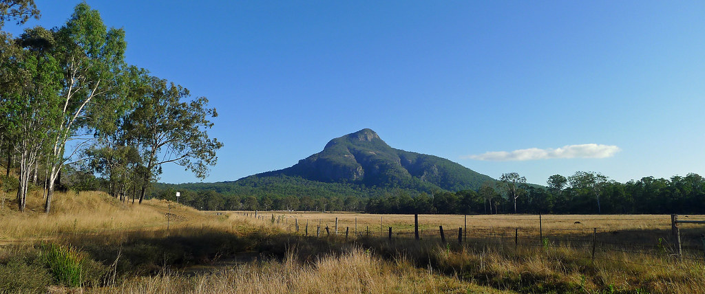
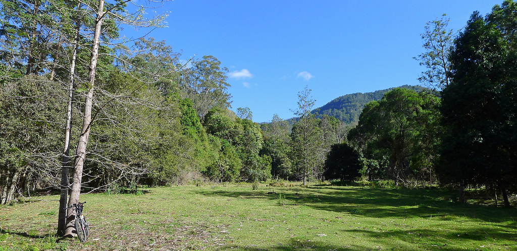
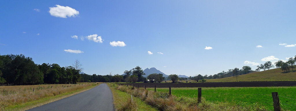
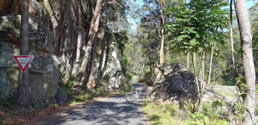
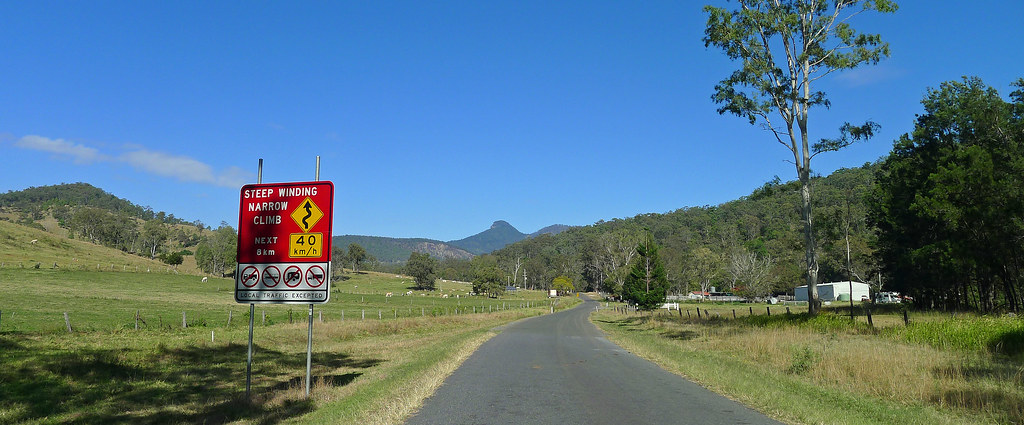
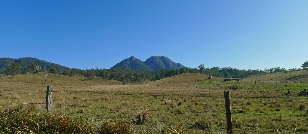
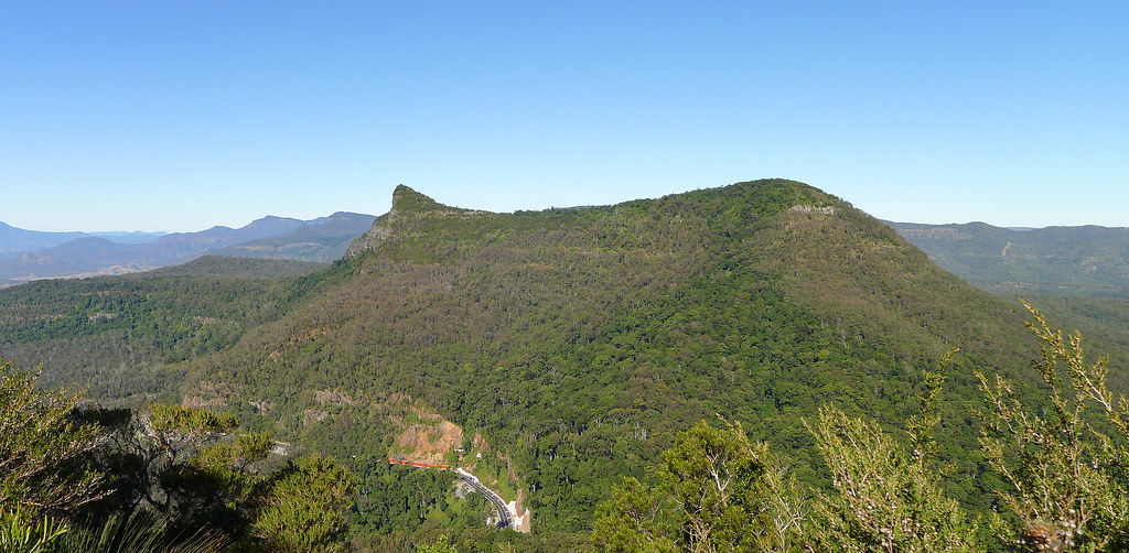
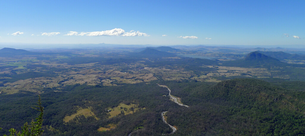
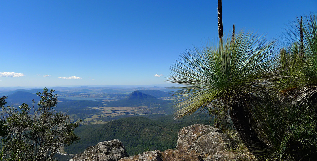
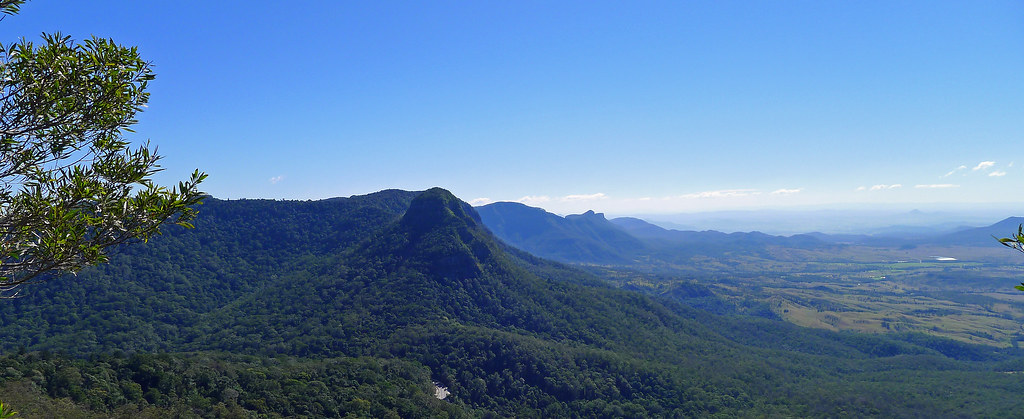
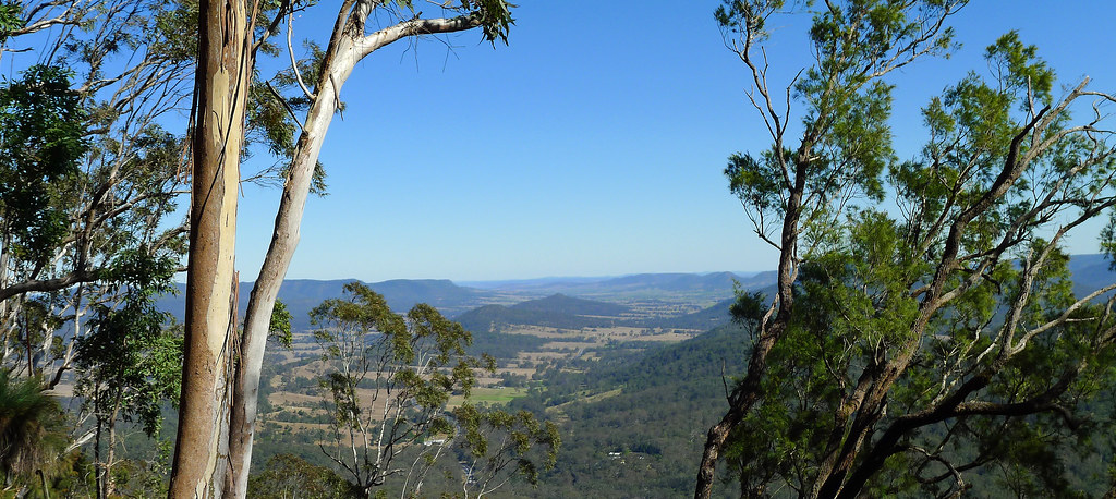
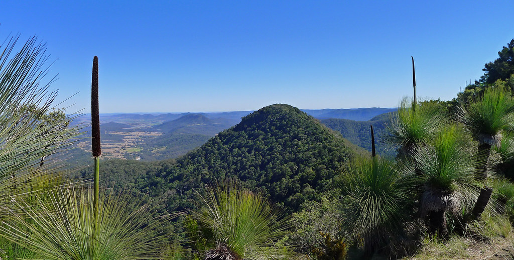
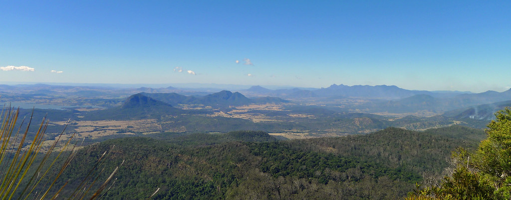
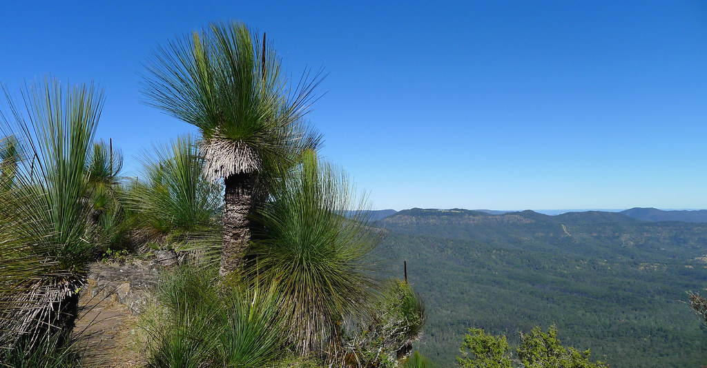
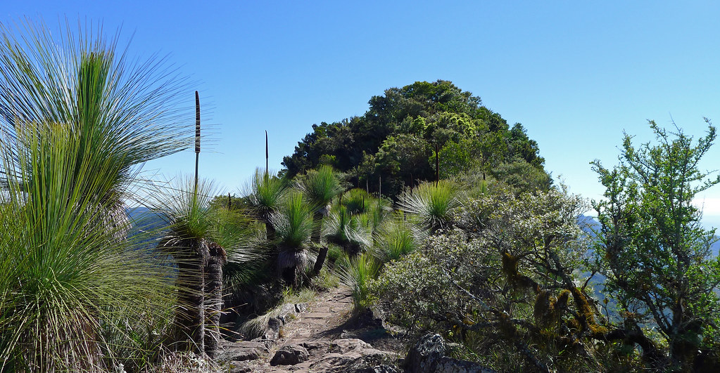
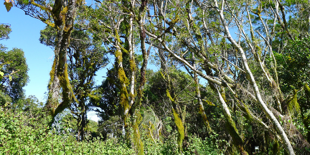
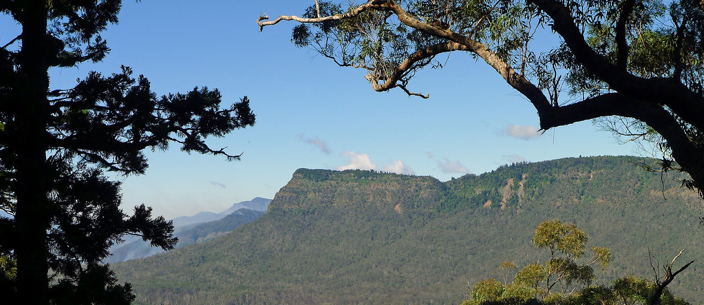
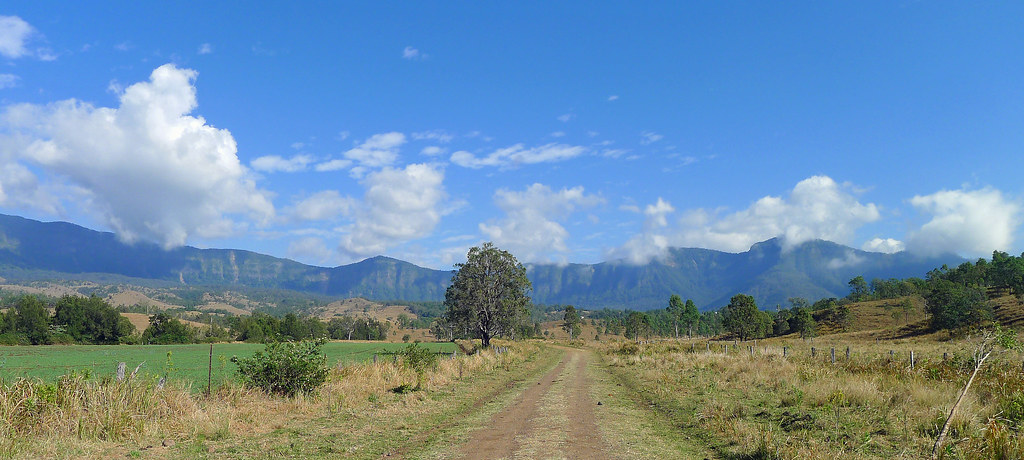
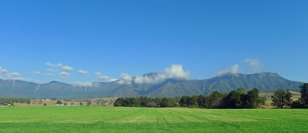
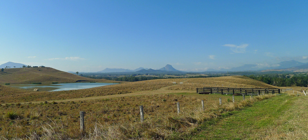
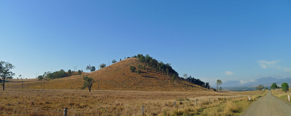
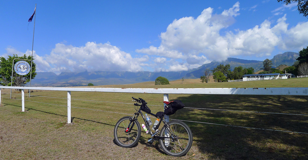
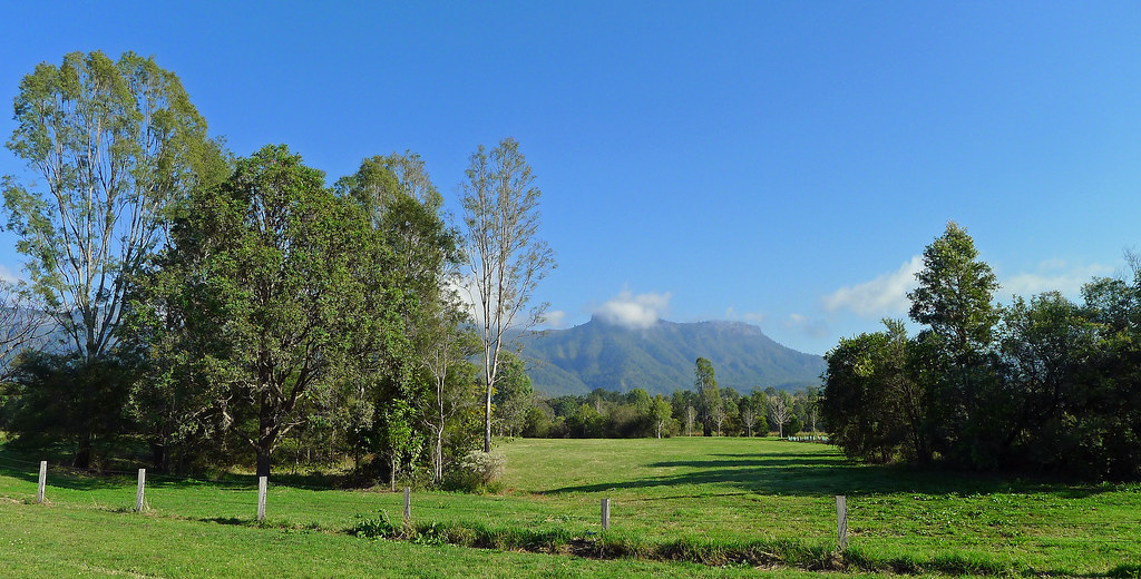
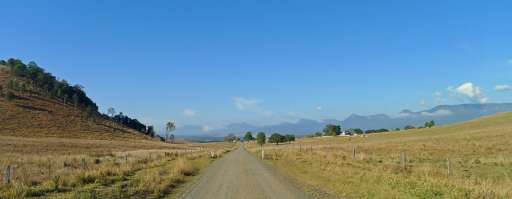
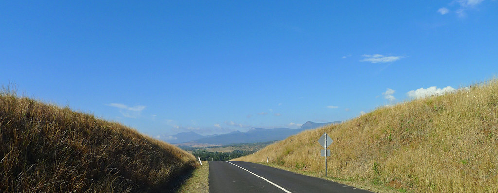
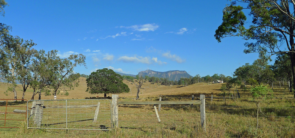
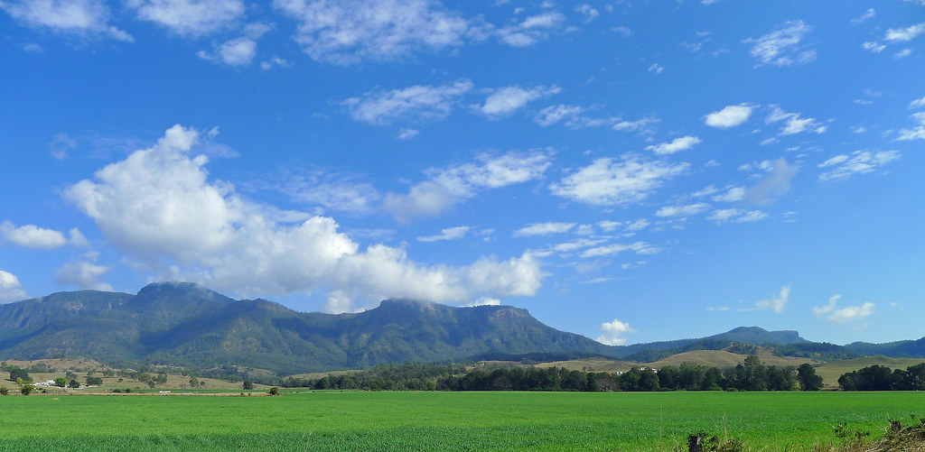
From the Rosevale Pub, the trail heads briefly east before turning south, following the bitumen through open farmland before the gravel is once again reached along the Moorang Wildlife Corridor. Sadly, there was more roadkill than actual wildlife visible as I past through the corridor on this day. The views are limited along this section as the bush crowds the road, but once the corridor ends, the bush opens up and the views along the eastern edge of the Great Dividing Range are breathtaking. From this vantage point, and until you reach Allan Cunninghams Historical Campsite, the steep eastern escarpments of the Main Range are your panoramic accompaniment while the ramparts of Mt Castle loom large, defending the trails route down the Bremer Valley. Simply put, the last 8-10km of this section of the trail, offers scenery that is nothing short of stunning.
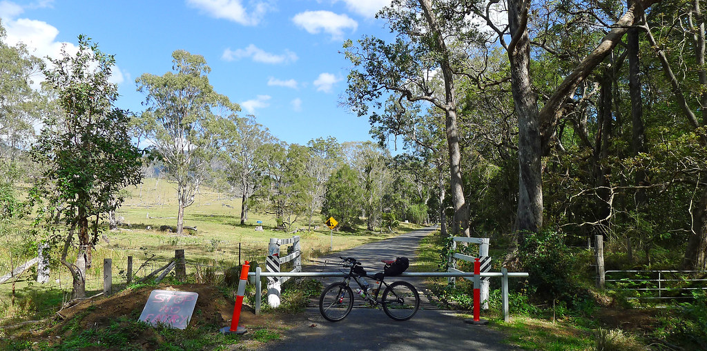
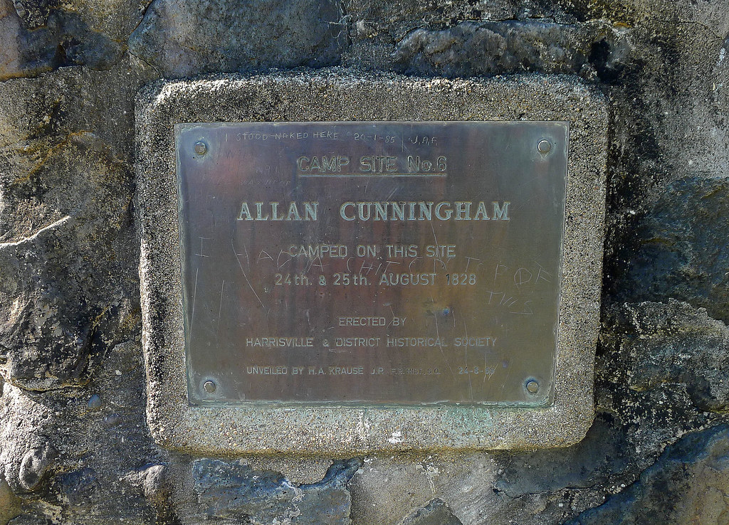
At the 21km point, Allan Cunninghmans Historical Campsite is reached. Here, on the 24th and 25th of August 1828, Cunningham camped during his expedition to find a route over the Great Dividing Range to the fertile western plains of the Darling Downs. On the morning of the 25th of August, 1828, Cunningham, from this camp, departed on a 13 hour 'trek' that culminated in him locating a pass over the Range and visualising, from the northern summit of Mt Mitchell, the Darling Downs, 'the beautiful tract of country' that he had explored the previous year. Arriving back at the campsite, that today, is commemorated by a stone monument and plaque, Cunninghman experienced a late evening storm that he claimed to be 'as awful, at the same time as grand, as any that are to be witnessed'. His journal, eloquently captures the atmosphere and beauty of the surrounding landscape;
With unabated violence the tempest continued until after midnight, when, as if suddenly exhausted, the wind moderated, the clouds broke, gradually sinking down towards the horizon; and a bright moon, just past the full, now burst forth with many a brilliant star, to assure us, by affording light to observe the extreme pinnacles of the mountains perfectly divested of clouds, that at length calm, serene and settled weather was again restored to us.
A short, easy section of the Bicentennial National Trail that, in the latter half of the route, offers some impressive scenery. I rode this as an out and back ride however, it would be more practical to combine this section with adjoining sections of the trail or, as part of a multi-day ride around the region.

 |  |


Tracklog; http://en.wikiloc.com/wikiloc/view.do?id=5123061