
Bicentennial National Trail;Teviot Brook Campsite to Killarney
Guidebook 6 of the Bicentennial National Trail (now out of print and available only in draft form and, as an ‘e-guide’) covers the Blackbutt to Killarney section. According to the Guidebook, none of this sections ~357kms' are particularly difficult for the cyclist. The route mostly follows the foothills of the Great Dividing Range passing just to the east of Toowoomba however, the range must be climbed just south of Toowoomba and again near the border. The Trail passes through a mixture of rough bushland and settled grazing/agricultural areas and makes use of the Brisbane Valley Rail Trail as it leaves Blackbutt. It is worth mentioning that significant sections of the Trail in this region were destroyed in the 2011 and 2013 floods. As a result, there has been some major re-routing of the trail to deal not only with flood damage but also land access issues. Thus, Guidebook 6 is available only in draft form at the present time. Despite this, the Guidebook is complete in that it provides maps and route notes for the entire section
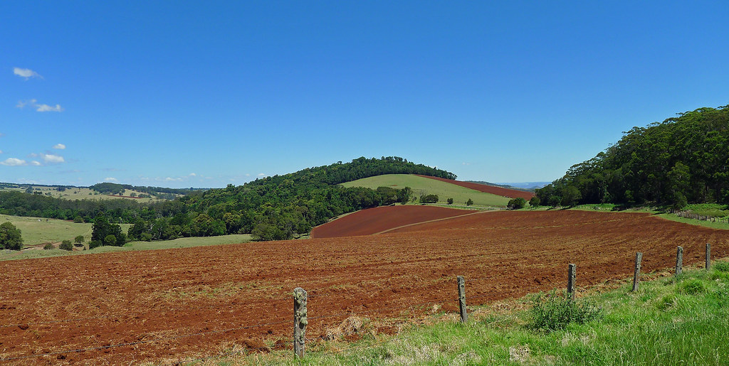
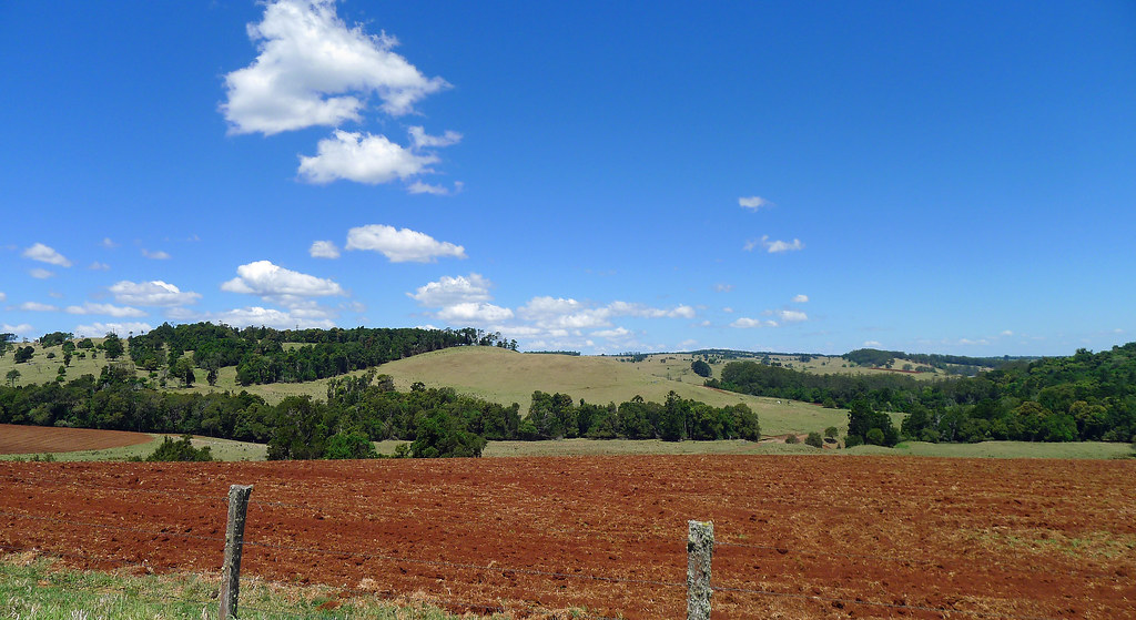
Guidebook 6 Map 17 and 18; Teviot Brook Campsite to Killarney (~32.50km)
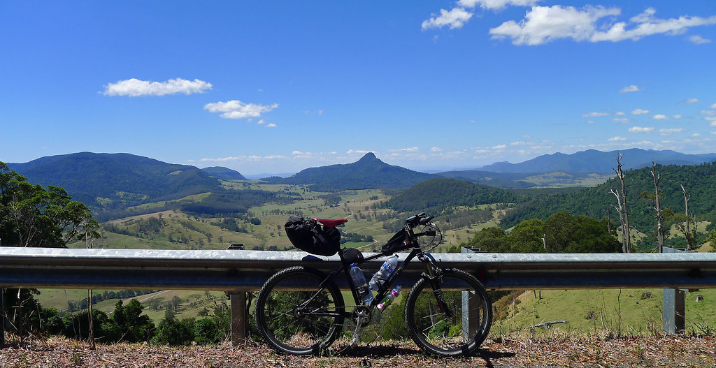
With an ever so slight window of opportunity offering, some respite from the hottest September on record, it was time to plug a hole in my Bicentennial National Trail ride map. Even better, a gap existed through what is most likely my favorite part of South East Queensland, if not Australia. At its highest elevation 'The Head ' is situated over 1000 metres above sea level and overlooks some of Queensland’s finest natural attractions – Condamine Gorge, Wilson’s Peak, The Border Ranges and World Heritage listed rain forest. Its name, portrays its location, at the head of the mighty Murray Darling Basin, whose waters arise from one of the nearby high peaks and end their journey some 3000km later in the Coorong, after existing the Murray River. The region is a feast for the eyes and has never failed to delight, whenever I have visited.
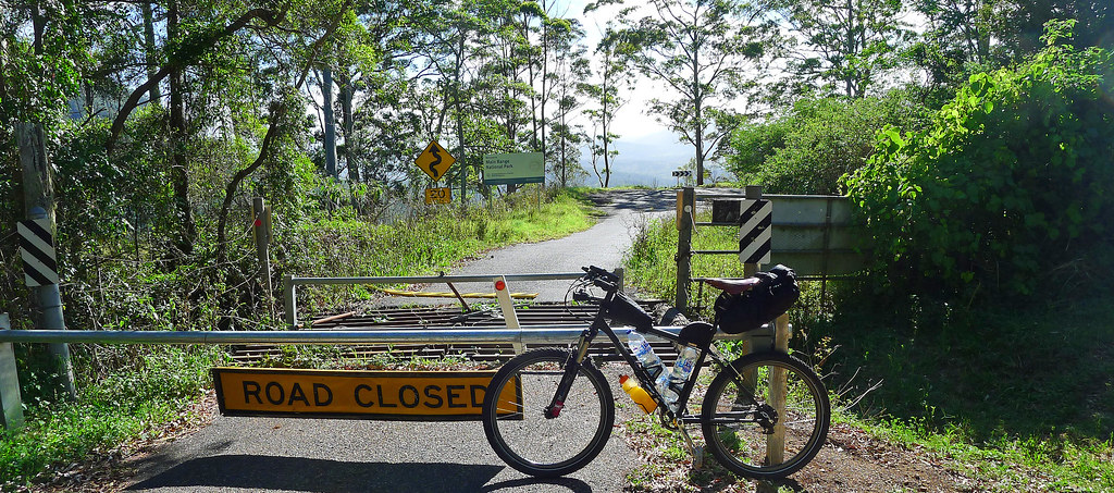
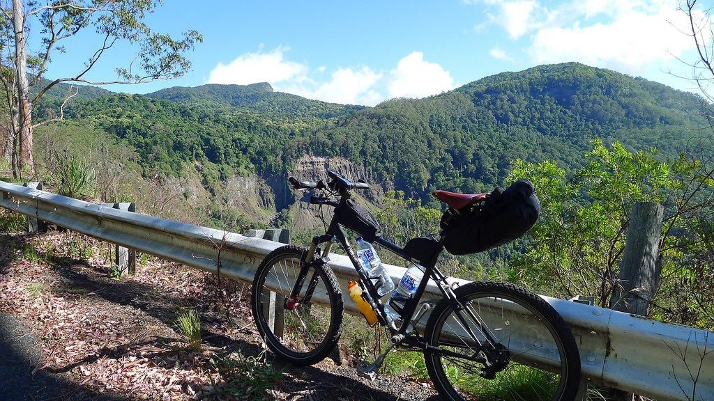
Picking the trail up where I left off in a previous post (http://www.thenorrisfiles.blogspot.com.au/2013/08/bicentennial-national-trail-munchows.html), the trail leaves Teviot Brook campsite and briefly follows the lower slopes of the Main Range before turning right and immediately heading towards the sky. The next four kilometres, along the Head Road, are steep, narrow and winding with some impressive gradients. The Head Road, from the bottom of the Main Range up to Teviot Falls Lookout, as a result of flood damage, has been closed and barricaded to traffic for most of this year. Sadly, this road may never be opened to traffic again (update; reopened May 2014) if the cost of repairing the damage is considered too great by the local council(s). However, that will be motorised transports loss and a cyclists gain, particularly, as it will eliminate the very real concern of meeting oncoming traffic on one of the many blind switchbacks.
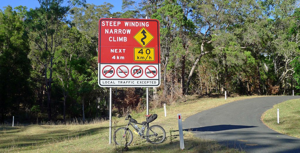
To a small degree, nature is already taking back the road and the landslips are not improving with time however, a traffic free piece of narrow bitumen through a national park, that gains 430 plus metres in elevation in under 3.5km, is gold to a cyclist and, in reverse, offers a breathtaking descent! Hitting the first hard pinch of the day I knew things were not 100 percent. Almost immediately I blew up, heart rate over 200 and more concerning, the odd missed beat. I rested, I pushed, I tried again with the same result. Now, it may have been from lack of sleep the previous night, or the two hour drive to the trail head or, the lack of an adequate 'warm up' into the first climb, or even the fact I was on a loaded 28kg steel framed touring bike, but this was becoming a little concerning considering what lay ahead. Another 100m of pushing, another attempt on the bike and this time the heart rate stabilized and the legs felt good. From there on, it was simply a steady, enjoyable and satisfying grind to the top of the Main Range and the Teviot Falls viewing area.
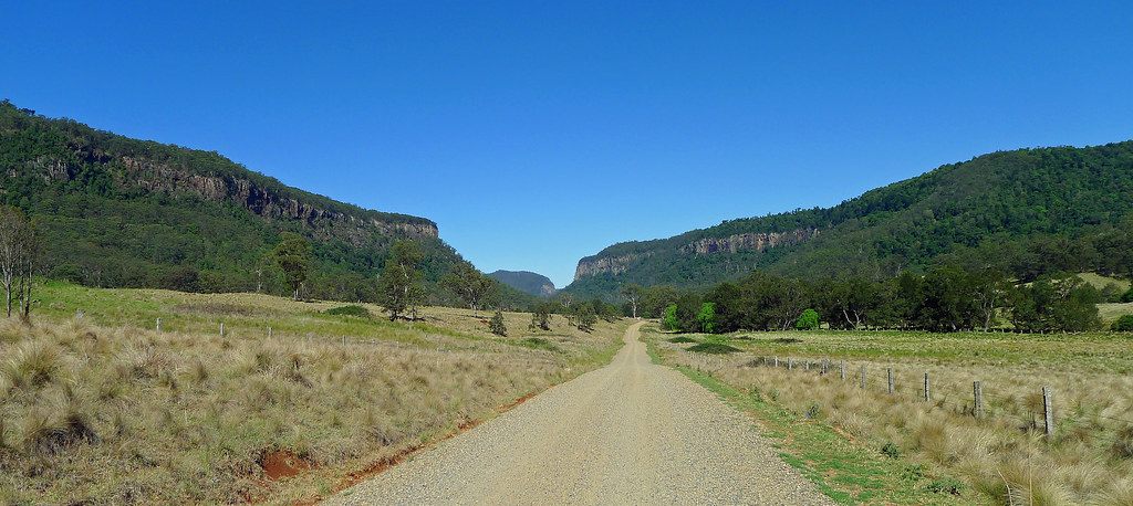
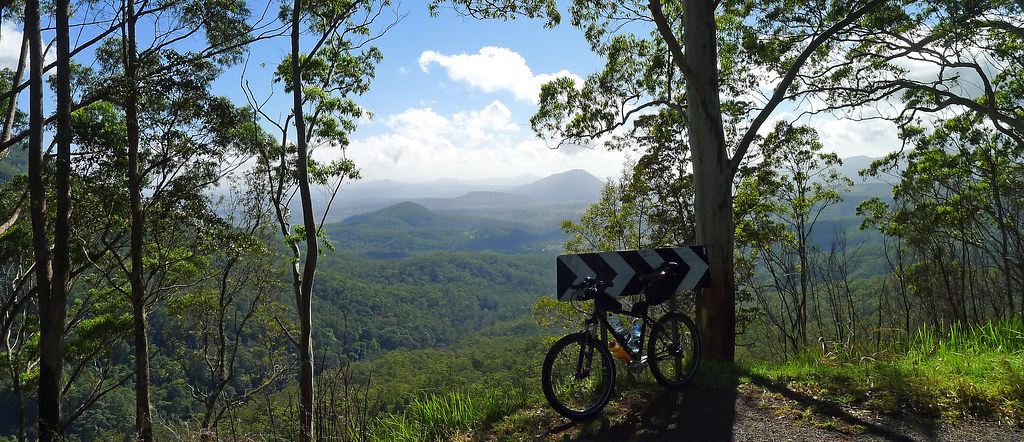
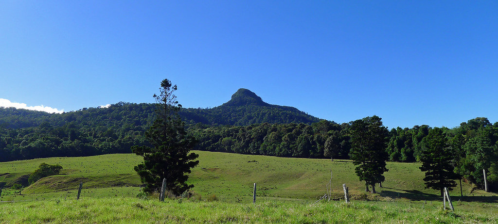
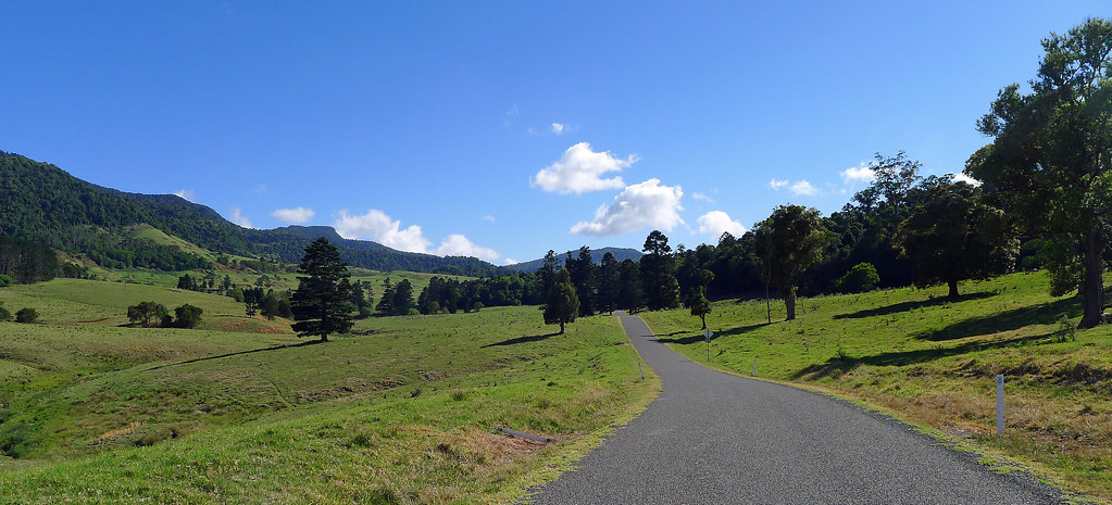
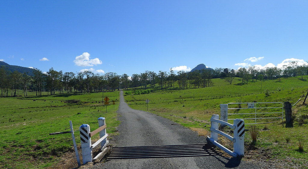
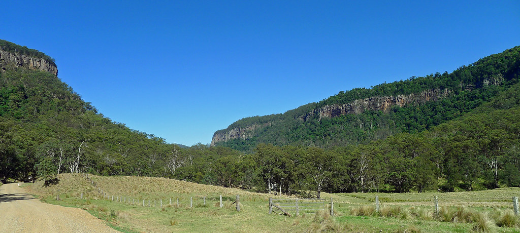
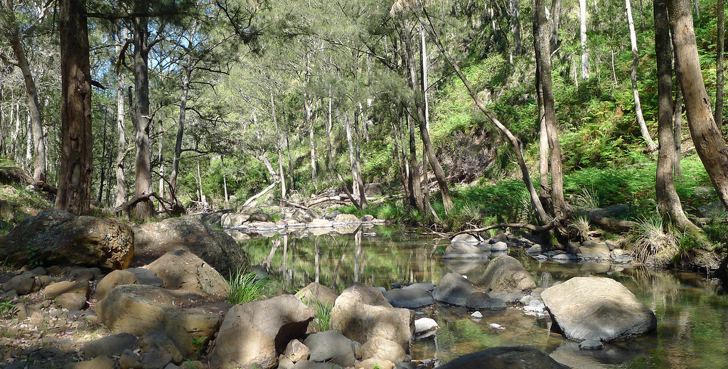
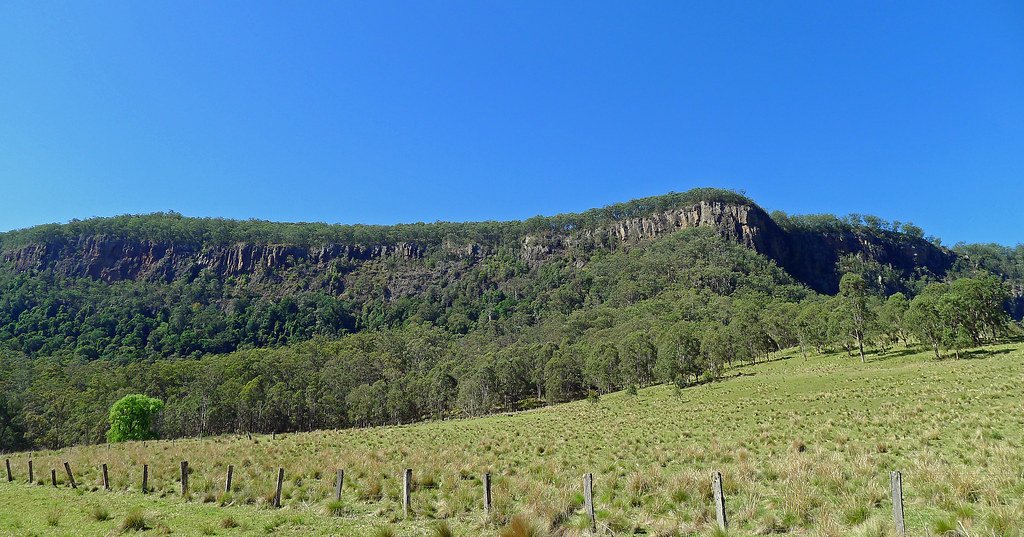
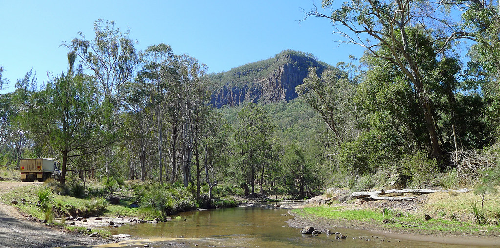
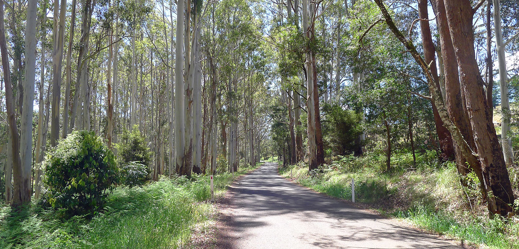
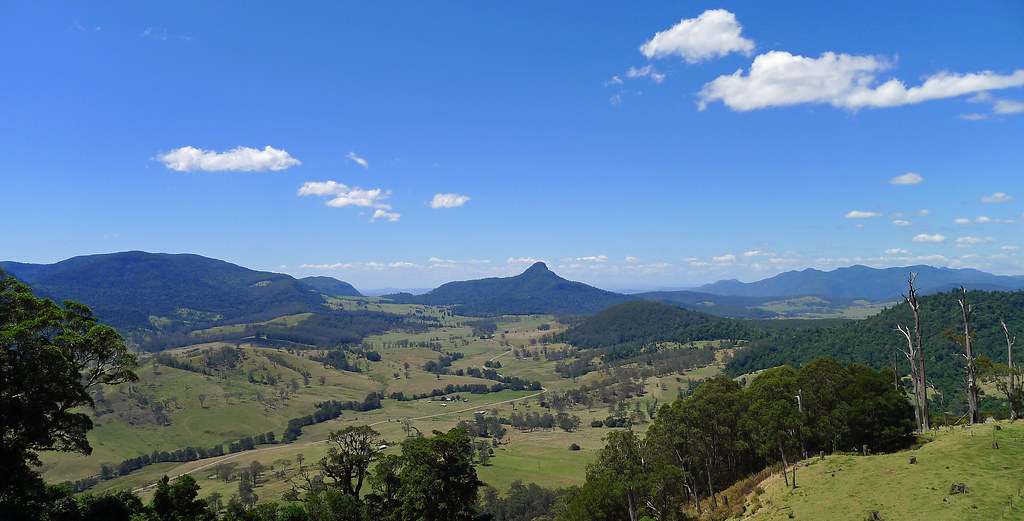
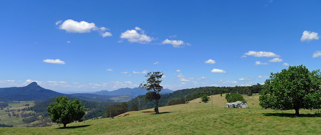
For me, it is always a special moment when you leave the closed confines of the climb up the Main Range, cross a cattle grid, veer slightly left and the impossibly green grassland valley of The Head opens up before your eyes. Ahead, the valley road is bordered by the the unmistakable contours of Wilsons Peak to the east and Mt Superbus, to the north. Centre of frame, the Cambanoora or Condamine Gorge narrows and cuts an impressive swathe through volcanic rock cliffs while high above, the irresistible vantage point of the Spring Creek Mountain Plateau beckons. Leaving the bitumen, the trail follows the dirt, though the gorge, along what is commonly know as the 14 River Crossing Road. In the past, the road through the gorge was used to carry supplies and mail to early settlers along the length of the gorge, and to bring timber to the railway in Killarney. Now, it is a popular 4WD and camping destination. This, at least in part, may be about to change.
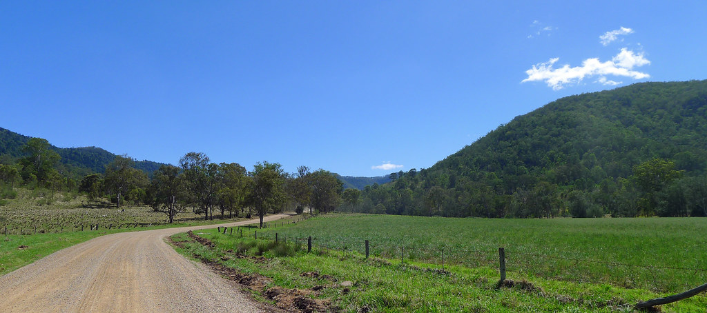
The track, normally a most peaceful and scenic ride, with abundant wildlife sightings and clear creek crossings was, on this day, a hive of heavy machinery and earth-moving trucks. Today, the wildlife had vanished. I have never ridden this track with out numerous snake, kangaroo, wallaby, frilly-neck lizard, goanna and lace monitor sightings, yet I saw none of the previously mentioned. The 14 river crossings, normally ice cold and crystal clear were brown and turbid. The track, at the best of times rough and bone-shaking or, depending on the weather, a mud bath, was, in places as smooth as a bitumen highway. The heavy machinery is temporary, the now smooth track, is not. It would appear, the council in conjunction with local conservationists want to adopt a 'tread lightly' approach. The new surface will see a decline in the number of 4wds' using the track which I suspect, is the councils plan. The locals would like to attract more bike riders, walkers and artists to the area, in a 'leave no trace' approach which, would help protect the 14 endangered, vulnerable, threatened or indicator animal species that make their home in the gorge. Whatever the outcome, there is no doubt of its beauty, not only in its unique geology but also in the broad range of flora and fauna present.
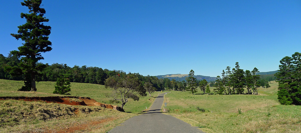
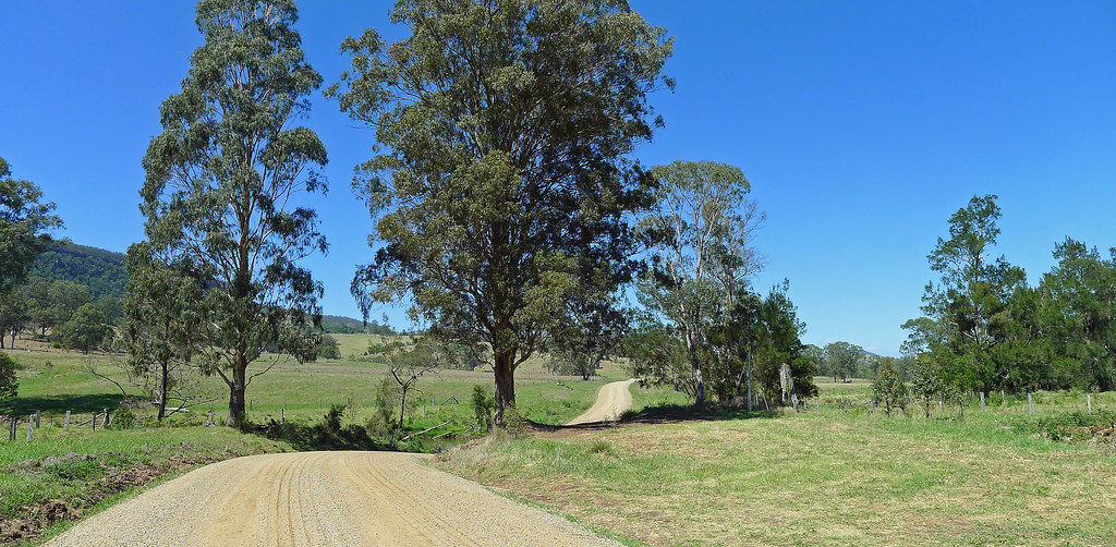
Approaching Killarney, the Bicentennial National Trail leaves the Condamine River Road and follows a convoluted route into South Killarney. The cyclist, will most likely want to continue along the Condamine River Road into North Killarney where most of the options for supplies are. A rider has numerous options for extended rides in the area. The trail can be followed further south towards Cullendore and the border gate or, a loop ride can be patched together that will take you across the border to Woodenbong, over the Acacia Plateau, through White Swamp before returning to The Head Road. Another option, and the one I chose, is to follow the bitumen up to the Spring Creek Mountain Plateau and enjoy the view from Carrs Lookout before a fast and long descent drops you from 1060m in elevation to 370m in a little over 15km.
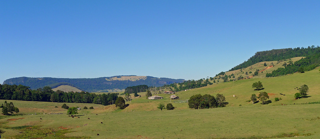
The ride up to the plateau (http://www.roadgrime.com.au/ride-routes/view/13/spring-creek-rd-carrs-lookout-) is long, between 13 and 15 kilometers depending on where you consider the climb to begin. Persistence and the use of granny gears will get you there, but in reality, its not that difficult a climb with some respite after the initial steep gradients are dealt with. At the top, Carrs Lookout, perhaps the most scenic lookout in South East Queensland, offers views over the valley where the Condamine River rises, and beyond to Mt Wilson and Mt Superbus in the Scenic Rim. A noticeboard commemorates the plane tragedy in 1955 on the nearby Mt Superbus, where a Lincoln bomber, on an emergency mercy flight crashed in inclement weather, killing all on board, including aircraft staff, nurse and the sick child. The wreckage exists to this day. Leaving Carrs Lookout, apart from a brief interruption along the valley floor, it is a fast and steep descent back to Teviot Brook campsite. What might have taken you hours to ascend previously, is all over very quickly. Riding solo, I was extremely careful on the descent and still easily clocked speeds over 50kmph Speeds in excess of 70kmph would be easily obtainable.. In sum, I think this can be considered one of the classic loop rides in South East Queensland, offering a variety of road surfaces, steep climbs and descents, sublime scenery and a chance for various wildlife encounters. Not the first time for me, but a 'must do', at least once, to my way of thinking anyway!
1) Bicentennial National Trail Route; http://en.wikiloc.com/wikiloc/view.do?id=5443787
2) Entire Loop Ride; http://en.wikiloc.com/wikiloc/view.do?id=5458204
Subscribe to:
Posts (Atom)