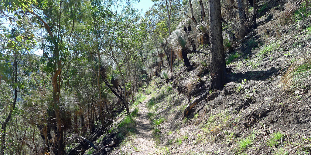
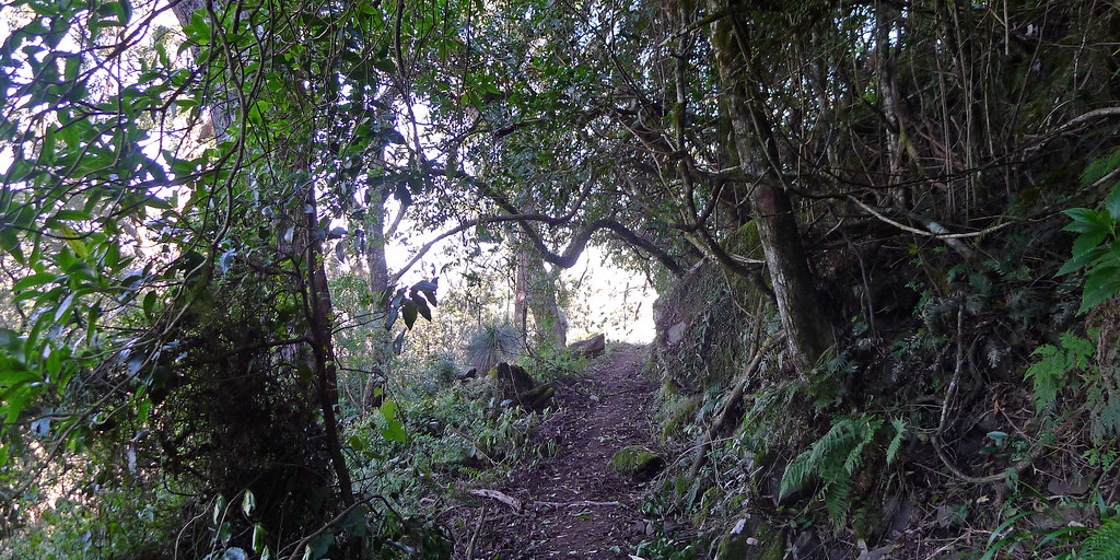
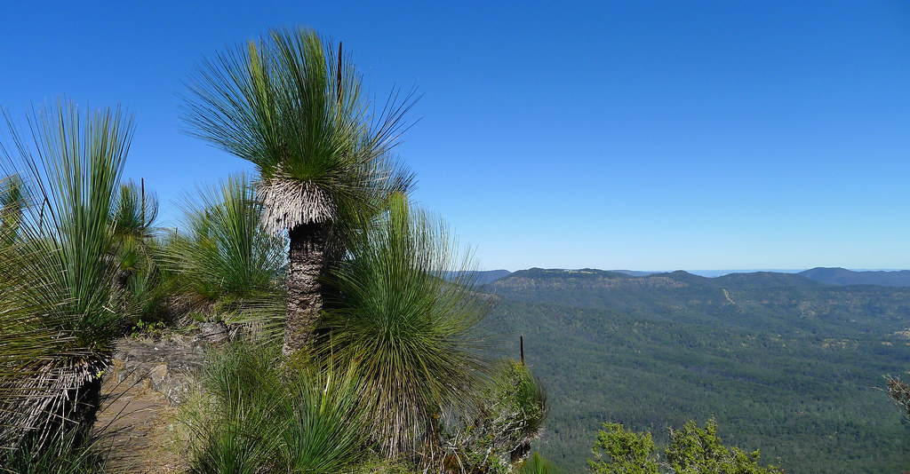
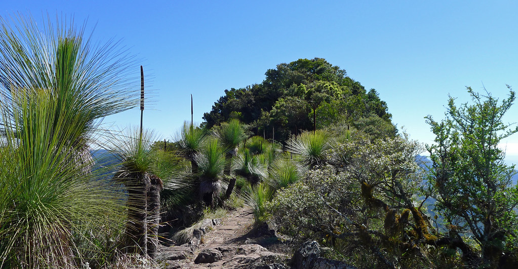
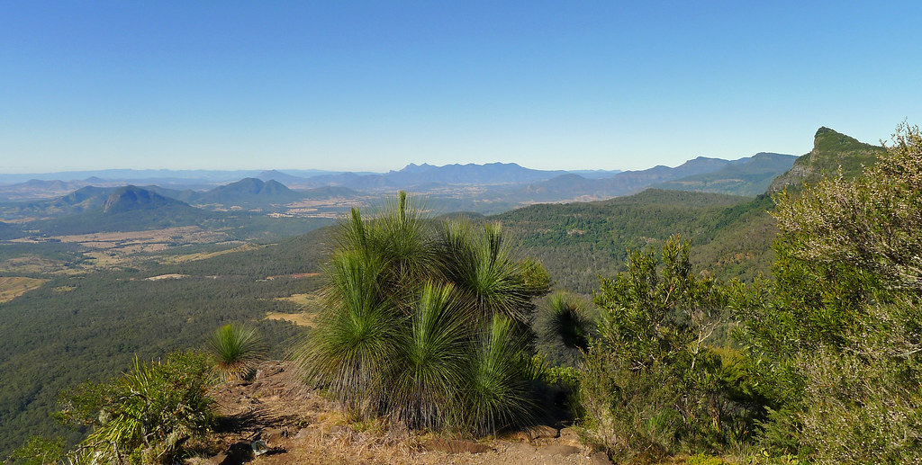
The Mt Mitchell track starts on the southern side of the Crest Carpark (Cunninghams Gap) opposite the (now closed) Mt Cordeaux and Bare Rock Track. The track has been closed since January of this year but has recently being reopened and it is now in the best condition that it has been in for sometime. The entire trail has been cleared, sections have been re-benched, drains re-built. and access over the recent, and impressive landslips have been created.
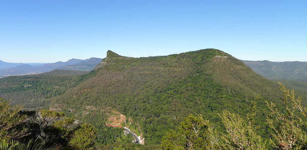
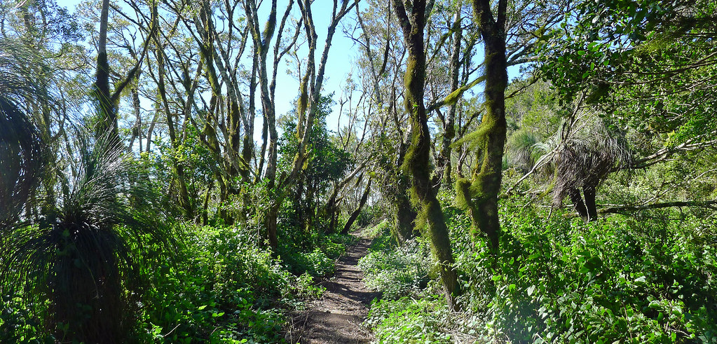
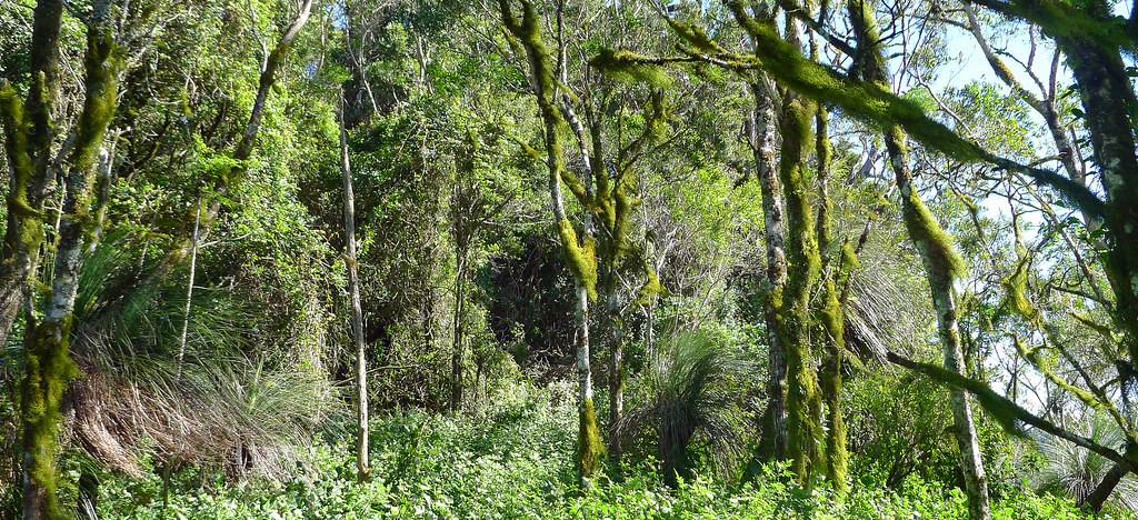
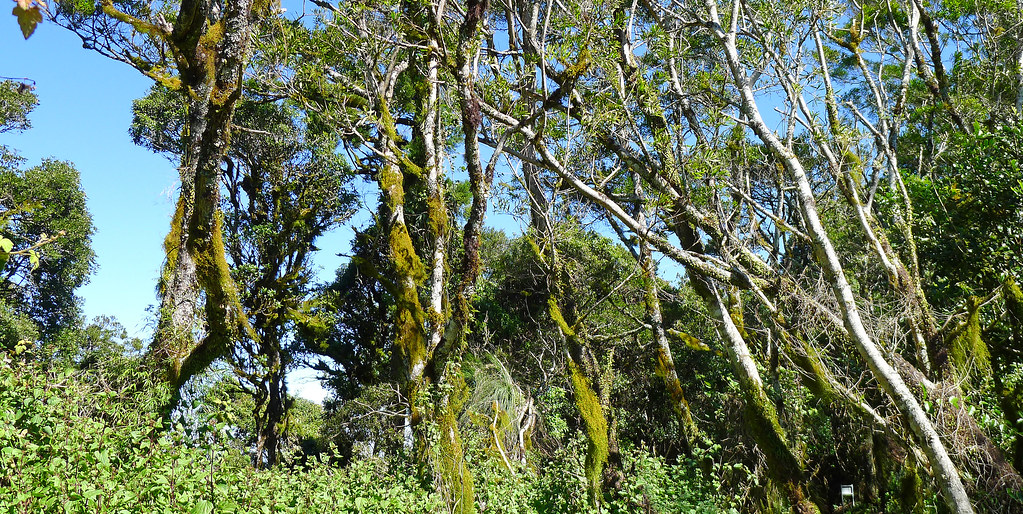
It is a simple return walk of less than three hours, first climbing through rainforest, then eucalyptus forest and masses of grass trees before reentering a small patch of rainforest. Leaving the rainforest behind the track emerges on the northern side of the west peak of Mt Mitchell before climbing to an exposed saddle and along an avenue of ancient grass tress before arriving on a razor back ridge which offers superb views in all directions.
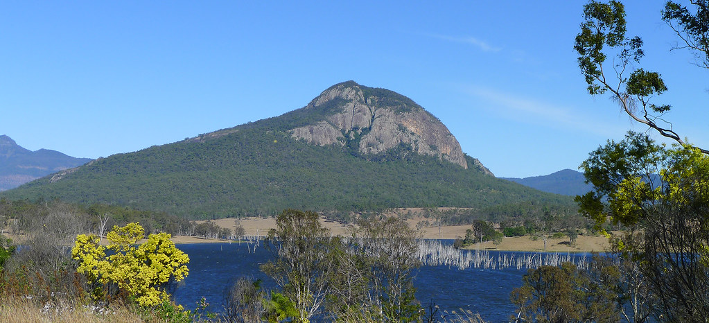
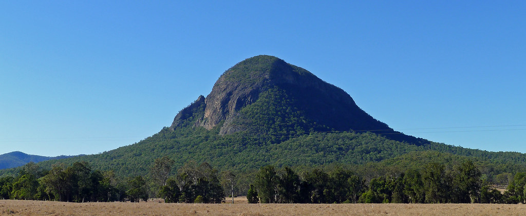
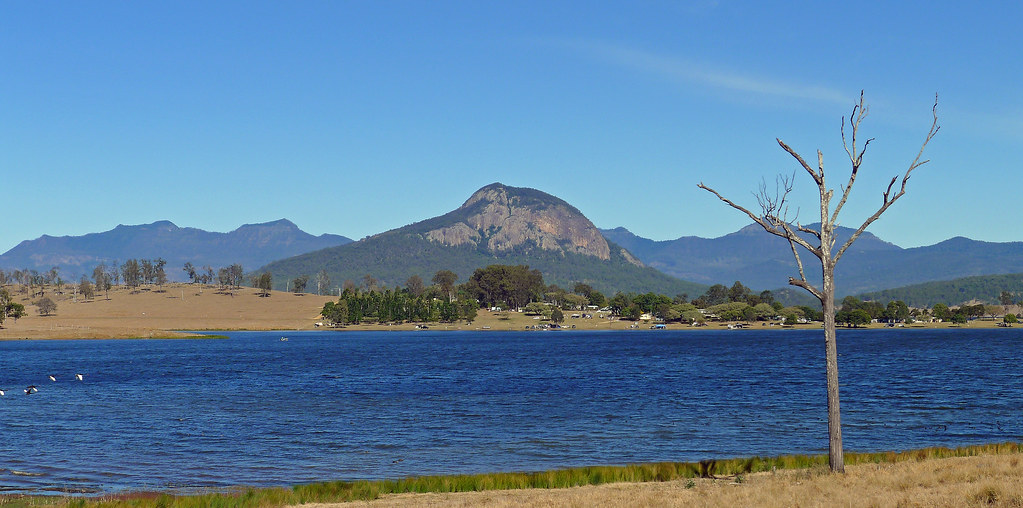
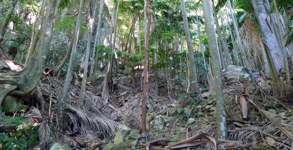
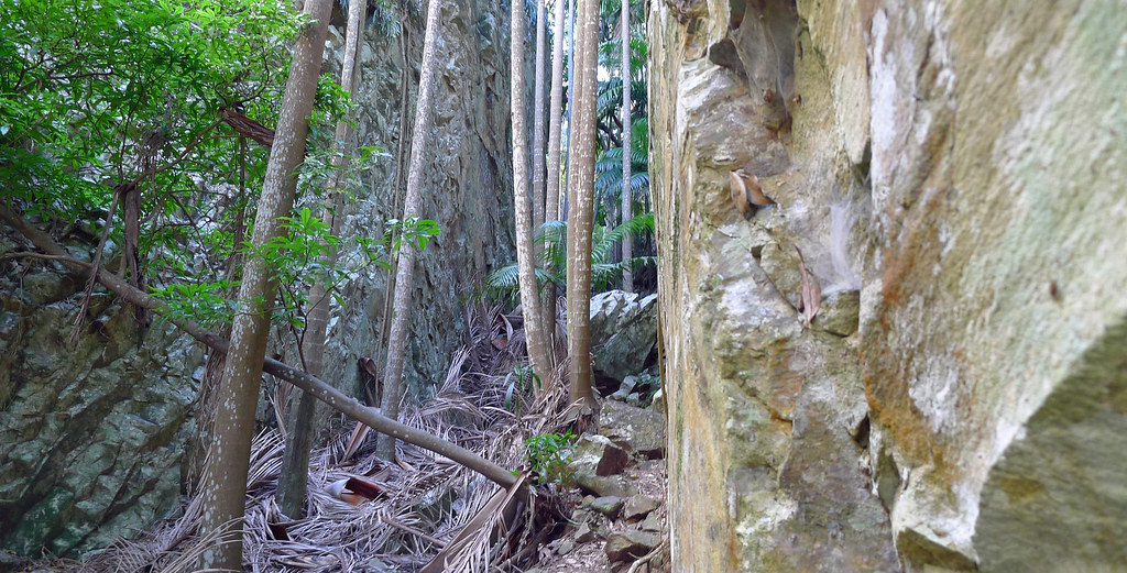
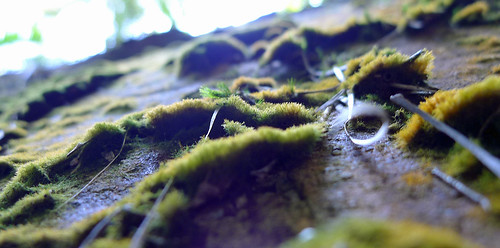
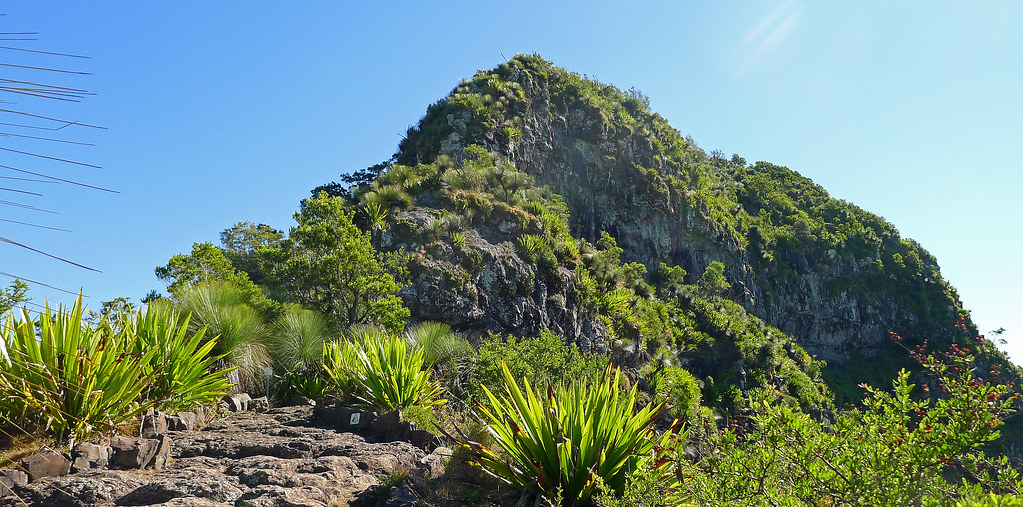
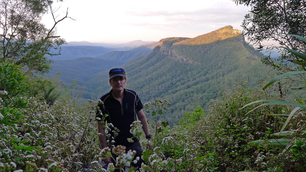
Mt Greville, to my mind, is one of the gems of the scenic rim. Without doubt Mt Barney is iconic and other peaks in the region are not without their own special appeal however; none of them have Palm Gorge or can arguably, offer quite the same diversity of landscape, terrain, flora and fauna at every turn that this mountain does. Palm Gorge (and Waterfall Gorge) is the jewel in the crown, offering a unique ascent route (or descent) between a narrow and steep sided gorge dominated by rainforest and carpeted by fallen palm fronds. Orchids, strangler figs, staghorns, ferns, mosses and lichen line the walls of the gorge while Piccabeen Palms tower overhead reaching for a glimpse of sunlight above the gorge walls.
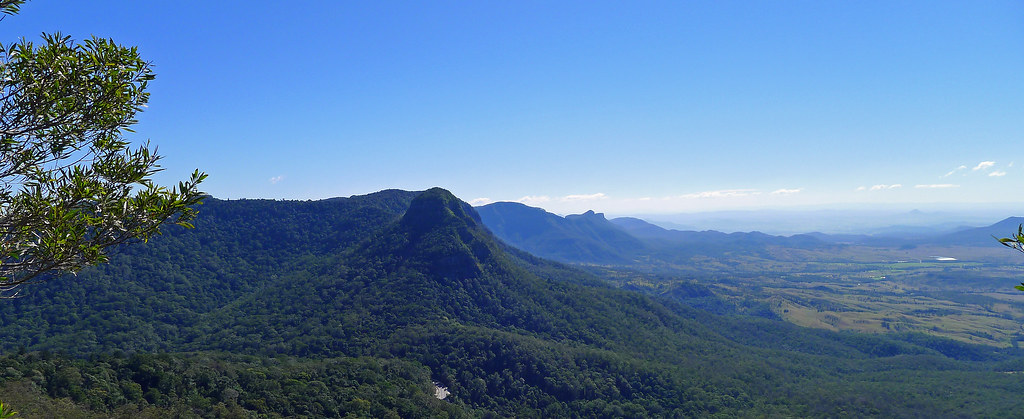
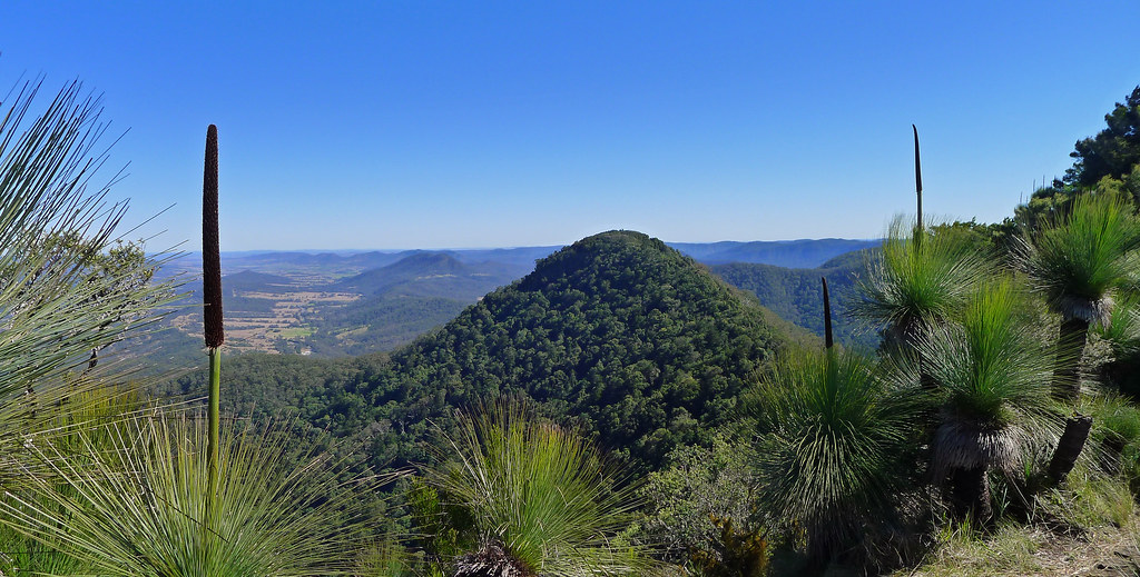
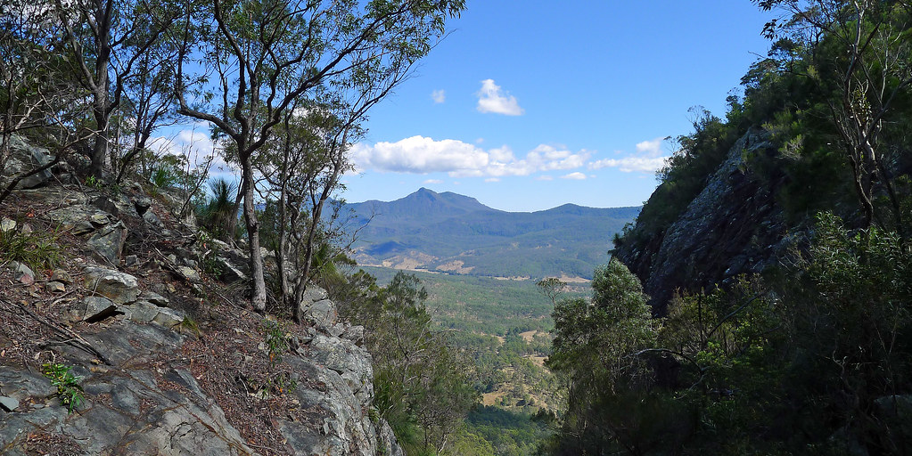
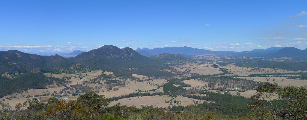
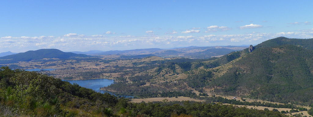
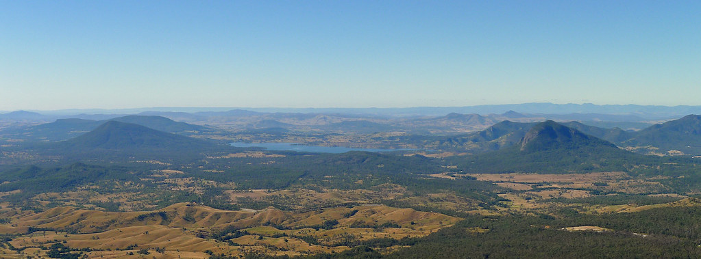
The views from the actual summit are limited but a rocky outcrop just west of the summit cairn provides an ideal position for lunch with superb views towards Cunninghams Gap and the Main Range ramparts. Boars Head, Mount Castle and the Hole in the Wall are all visible while to the North lays the conical shape of Mt Edwards and the blue expanses of Lake Moogerah.
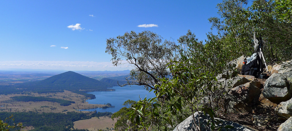
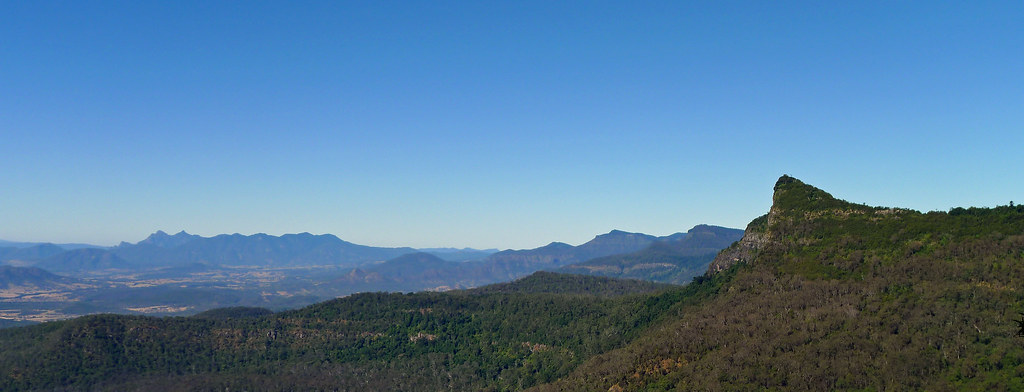
My descent from the summit was across the scree slopes and rocky slabs of the south east ridge that offered views down into the twin gorges of Waterfall Gorge to the left and Palm Gorge to the right. The view out over the Fassifern Valley is dominated by Mt Moon and the rugged finger of rock that is Glennies Pulpit while below, an inlet of Lake Moogerah ekes a path over the lowlands. In the distance Mt Barney and the Mt Ballow massif dominate the horizon and the ridge of the Main Range extends to the west until it reaches Spicers Peak. Another great day out in this region with perfect weather to match the surroundings.
I have had these photos from when I visited this part of
Switzerland lying around for a few years now, but I had never gotten around to
posting them. They were taken with an old cheap camera and I was never overly
happy with their quality, nevertheless I decided to tidy them up a little,
run them through a slideshow program and compress them into a video. I prefer
Vimeo for this process but the compression program did such a poor job that I
elected to try YouTube for the first time. The results are definitively better
through YouTube and considering the cheap camera used I’m relatively happy with
the results.
(Best quality achieved in fullscreen and 1080 HD)
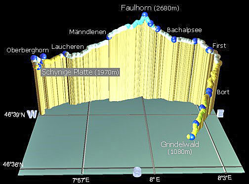
This day walk ranks as one of the most spectacular and scenic
hikes in the Bernese Oberland/Jungfrau area, and offers jaw-dropping views in
all directions. It leaves from Schynige Platte at 1969m, ascends to
Faulhorn at 2680m and ends at First which is 2180m above sea level. I extended
the route to Grindelwald where I was staying which took me back down to an
elevation of 1034m. It’s a big day out with at least a kilometre of vertical
altitude gained and a similar amount to descent, plus another 1100m if you
chose to walk from First down to Grindelwald. The main trail from Schynige
Platte to First is 16km but as I continued on to Grindelwald, which I guess
added about another ~6-8km or 2-3hrs walking if you take that option (a gondola
from First is available, but if you miss the last gondola you have no option
but to walk down to Grindelwald).
The start of the walk is reached with a 50 minute trundle on
the old and slow cog wheel rack railway which leaves from Wilderswil (586m) and
climbs to Schynige Platte, (1967m) home to beautiful green meadows and at the
right time of year, masses of alpine flowers. The steep cog railway offers
spectacular views of the Brienzersee and the Jungfrau and is a pleasant prelude
to the days walk.
The walk itself is simply stunning, and, has it all! Far
below, I was able to peer down on the turquoise waters of the Brienzersee, and
the alpine lake of the Thunersee while above, the skyline was dominated by the
peaks of the Niesen and the Niederhorn. Below, lay the endless green valleys of
Grindelwald and Lauterbrunnen which are surrounded by the majestic towering
range of the Wetterhorn, Eiger, Mönch and Jungfrau mountains. Passing wild
scree slopes and many beautiful small alpine lakes I descended into a valley in
which nestled the not so small but postcard perfect Bachalpsee Lake. From this
valley I could see the Rötihorn away to my right while across the lake, the skyline
was dominated by the peaks of the Wetterhorn and Schreckhorn.
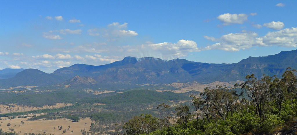
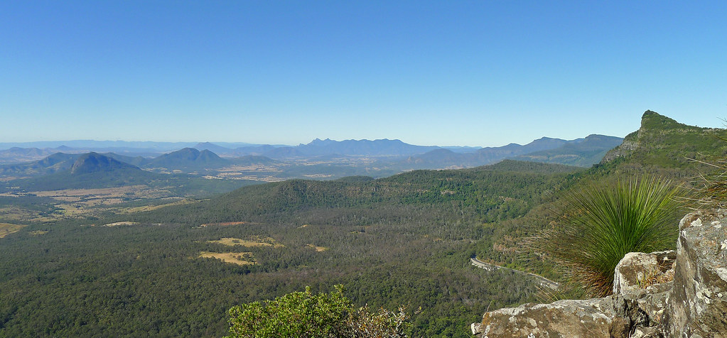
Cunninghams Gap divides Mt Mitchell from its more northerly neighbouring peak of Mt Cordeaux. From the Gap, the climb to Mt Cordeaux commences from the eastern end of the car park and passes the memorial to Allan Cunningham before climbing to the Mt Cordeaux Lookout. The lookout is located just below the 1135m summit of Mt Coredeaux, on an exposed rocky slab which catches the morning sun. It was one of those beautiful South East Queensland winter mornings, a little chilly in the rainforest sections of the track but once the exposed sections of the track are reached, the winter sun takes the chill from the air.
En route to the lookout, on an exposed rock ledge, the head of a mine shaft is located, guarded only by a low chain wire fence. Here, in the early 1900’s, persuaded by a conman with a handful of ‘fools gold’, two local brothers sold their farm and bakery to fund their dream of striking it rich on the mountain. It took years of toil and hardship before they eventually exposed the fraud. It is a sad and permanent reminder of a futile enterprise.
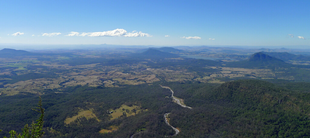
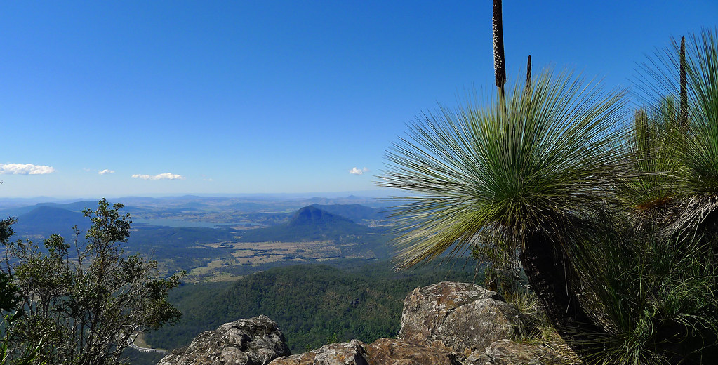
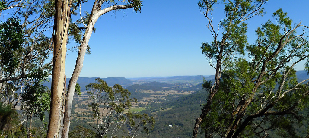
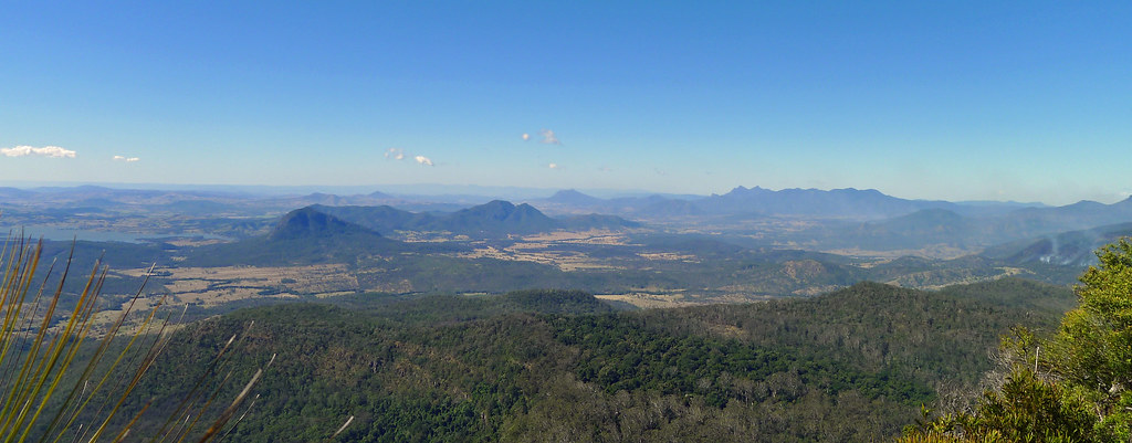
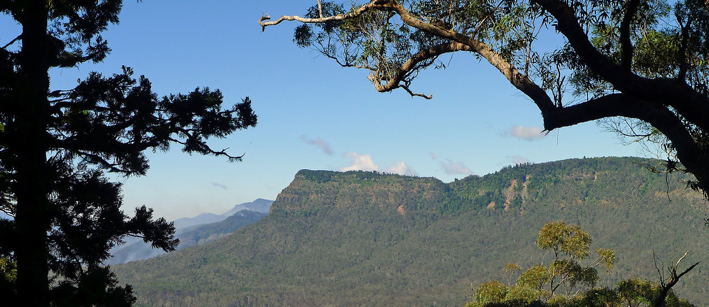
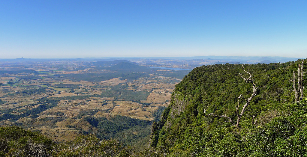
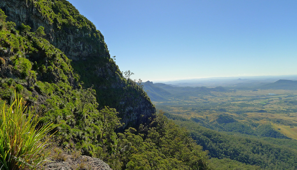
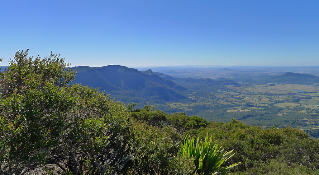
Mt Cordeaux Lookout provides near 360 degree views; to the north over the ramparts of Mt Castle, east over the scenic rim and further to the sand hills of Stradbroke Island, while to the south, the tip of Mt Warning rises above the Lamington Plateau. Slightly above the lookout the actual summit of Mt Cordeaux rises steeply, (a scramble will get you to the summit but it is not worth it for the views alone as they are superior from the lookout) while below the summit the sheer cliff line is covered with spear lilies’.
Leaving Mt Cordeaux Lookout the track heads west on its way to Bare Rock and hugs the southern cliff line of Mt Cordeaux before emerging onto a narrow exposed ledge that links Mt Cordeaux with the rest of the range and offers stunning views back to its summit (This is the access point if you want to scramble off track to the summit). The track then heads uphill through rainforest before finally a brief and simple scramble deposits you onto a wide exposed rock slab that is Bare Rock. Bare Rock offers similar, near 360 degree views to Mt Cordeaux, perhaps allowing for a little more of the north western aspect however; undoubtedly, it is the best vantage point to view the ramparts of Mt Castle, Boars Head and the razor back ridge that ascends to Mt Castle. Perhaps, later in the day, it may be even be possible to spot the Hole in the Wall, when the sun has dipped below the horizon. My suggestion, would be to save your morning tea or lunch for this spot as the mostly unhindered views are probably only bettered in this region by the completely unhindered views offered from the summit of Mt Maroon. Returning to the main track junction I followed the out and back track to Morgans Walk however, this tracks ends abruptly and is mostly overgrown with minimal views in any direction. The 6-7km return journey gave me a chance to get some easy trail running miles into my legs, albeit downhill ones’! A fantastic end to a typically beautiful South East Queensland winter morning!
This walk actually ended up being a Goomburra to Laidley Creek Falls campsite nonetheless, thanks to Cam, http://hikinginseqld.blogspot.com for the idea and GPS route and the invaluable Take a Walk book for track directions.
The plan for this walk was to drive to Goomburra in the Main Range National Park and from Sylvester’s Lookout car park walk to Laidley Falls campsite before negotiating the scramble onto the summit of Mt Castle. After exploring the main peak a little we would set up camp close to the eastern peak with its sheer cliffs. The next morning after enjoying sunrise from Mt Castle, we would return along the same route. However, as is the way with bush walking, things did not go quite according to plan.
We left Brisbane a little later than I had hoped and after a quick breakfast at Aratula it was getting close to midday before we arrived at Goomburra and the picnic area at the base of the Main Range Nation Park. There, with mutual groans of dismay, we found that the road that ascends significantly to Mt Sylvester’s Lookout had been closed due to the deluge experienced over the past week. Abandoning the walk wasn’t an option so we organised our gear, donned our packs and commenced the trudge that rose 350m in elevation over 5.2km. We arrived exhausted at around 1:30pm, threw down our packs, and over lunch admired the expansive views from Sylvester’s Lookout.
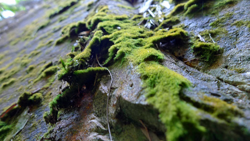
Leaving Sylvester’s Lookout the track headed north and became very rocky descending into a gully before climbing steeply and then levelling on the top of the ridge at 1142m. Following the track notes from the guidebook, we continued on until reaching a point were a huge liana vine hung from the canopy, here we turned sharply left. The track then descended down a pile of mossy rocks that lined the crest of the ridge before veering towards the south east, close to the edge of the escarpment.
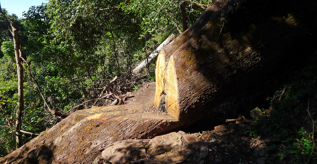
Continuing along the ridge we turned sharply right across a fallen log at a narrow gap between the rocks on the ridge top. We then commenced the descent on the right side of the ridge through what appeared to be a frost or fire affected exposed area of open eucalypt forest dotted with tall grass trees and a thick grassy ground cover. Route finding became a little more difficult as the vegetation often obscured our view of the track and numerous false foot pads heightened our indecision. As Cam noted in his blog http://hikinginseqld.blogspot.com the best advice for this section is to ignore the tracks that appear to be the most direct descent down the ridge but rather follow the track that hugs the obvious escarpment.
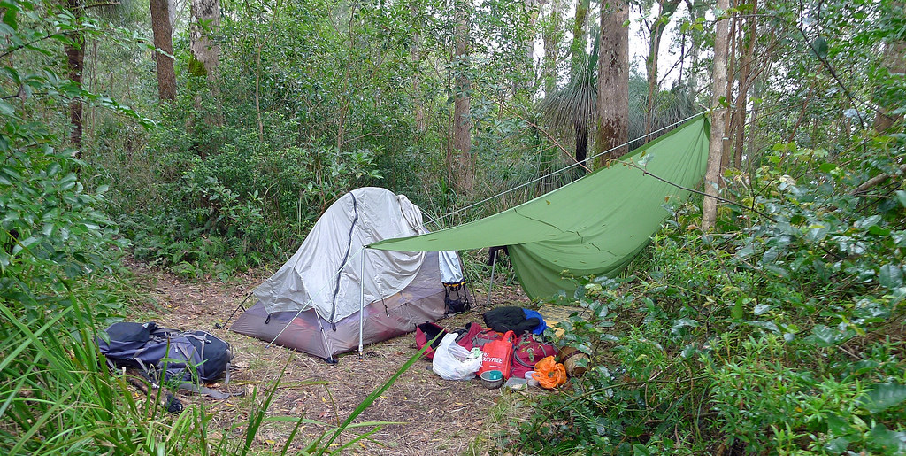
To our disgust this section of the track was infested with ticks. Our trousers, shirts, and exposed skin were quickly covered in ticks and our progress slowed as we continually checked ourselves for any of the beasts that had managed to get a grip. The final descent into Laidley Creek Falls campsite (940m) involved a few muddy and slippery downhill sections before the track curved north east towards a small cleared area that was the campsite.
By this time is was getting close to 4:30pm so there was no chance of us getting onto the summit of Mt Castle that evening so the decision was made to camp the night at Laidley Falls campsite. Dumping our gear we headed down the most obvious foot pad leading north west away from the campsite. This brought us to Laidley Creek which only had a trickle of water flowing but enough to refill out water containers. The cliff face at the edge of the falls offered expansive views over the Laidley Valley and onto Mt Castle. In the dying light it was difficult to locate the guidebooks recommended route towards the Hole in the Wall as numerous foot pads littered this area.
Returning to the campsite I following an obvious trail leading north form the campsite and arrived at an exposed bluff with stunning views north, north east, over the Laidley Valley, Moogerah Peaks, back along the Main range and towards the southern end of Mt Castle with its rugged buttress glowing in the setting sun. From this position Cams http://hikinginseqld.blogspot.com more direct ascent onto Mount Castle than the guidebooks recommended route became obvious. A rocky ridge line led towards Boars Head before narrowing to a razorback then climbed towards the base of the cliffs that line Mt Castle. At this point we both decided that tomorrow we would attempt the more direct route onto Mt Castle rather than follow the guidebooks advice as we were concerned that we may end up a lot lower down in the valley than was necessary.
Back at the campsite the ticks were horrendous but somehow we managed not to get into our shelters until after midnight. Feeling optimistic and placing faith in the BOM forecast I only put up my tent inner however, by 0200am the temperature dropped dramatically and the wind increased significantly bringing with it rain. I must have dosed off at this point because I came to as Darren was putting the fly over my tent inner. Thankfully I hadn’t got that wet and he had managed to stay dry under his tarp. The rain continued overnight and by 0800am neither of us had made a move to rise as the weather was miserable and attempting the climb along the razorback ridge to Mt Castle seemed risky and unappealing. Added to our woes the ticks had declared open season on Darren overnight as he had little protection under his tarp and the morning light revealed there handiwork. A day or two after the walk he developed some mild cellulitis presumably from a tick head left in his skin. Thankfully it resolved quickly. I was glad of my own protection as the morning revealed dozens of ticks on the inside of my tent fly but happily separated from me by the mesh inner.
A long breakfast over numerous cups of coffee ensued while sheltering from the rain under the tarp. Before leaving the campsite we detoured out to the exposed bluff we had visited the previous evening. The valley below us had disappeared under cloud and Mt Castle was invisible, as if it didn’t even exist and we could only vaguely make out the route along the ridge line towards it. Strong updrafts drew the clouds up from the valley floor then with staggering force and speed thrust them above us and over the top of the Main Range. It was an incredible spectacle and a display I had never witnessed before or at least not with updrafts that immensely powerful and visible.
The rain had made some of the sections of the track back to Mt Sylvester’s quite perilous. The muddy uphill sections required some deliberate foot placement to avoid a slide but other than a few heart in mouth moments it was a relatively uneventful walk back to the lookout. We had made the decision to wear long thermal pants as well as long sleeved thermal tops which together with bright coloured rain gear seemed to limit our tick exposure on the return trip. At the very least the bright coloured and slippery wet weather gear made it easy to spot the ticks and remove them. After a short stop at Sylvester’s Lookout we set off on the knee crunching walk back down the park road to the car. At least it was downhill this time! Back at the car after a tick inspection and removal operation we traveled down Cunningham’s Gap back to Brisbane and home.
Despite not getting to our destination, the ticks and rain, the unexpected uphill slog to the start, this walk was still enjoyable. I took very few photos which is unusual for me however, that is one more reason to come back. When we do, it will be winter, away from tick season and we will camp on the summit of Mt Castle.
Mt. Edwards is located in the Moogerah Peaks National Park. Its conical shaped peak rises up from the Cunningham Highway. The walk to the summit started with a stroll across the Moogerah Lake dam wall before I followed a rough track that zigzaged steeply uphill alongside Reynolds Creek Gorge. Passing a rocky slab and an exposed rocky outcrop I reached Gorge Lookout which provided views to Little Mt Edwards and the scars etched out of its face from water course erosion, Reynolds Gorge and Reynolds Creek, in which I am reliably informed, is home to the platypus!
Leaving the lookout the track becomes less distinct and climbs steeply over numerous stone steps. This part of the mountain has been affected by bush fires in recent years and the regrowth is dominated by hoop pines , eucalypt and grass trees. The track then almost levelled out as it lead North West initially then veered abruptly to the right for the final climb to the summit.
Two hours after leaving the car I reached the summit which is declared by a brass Survey Office of Queensland permanent marker. The south easterly views from the summit extend down to Reynolds Creek and across to the steep cliffs of Frog Buttress and the prominent flat top of Mt French. Further north the view below stretched out across a chequerboard mosaic of farming land while on the horizon the ‘skyscrapers’ of Brisbane were vaguely visible through the heat haze. A short track lead around to the West and offered some foliage impeded views towards the Great Dividing Range.
The descent via the same route took about an hour and was easy despite my complaining knees. The reward for that effort was lunch at the Sugar Loaf Bakery in Boonah. Superb pies and cream buns made with real cream!
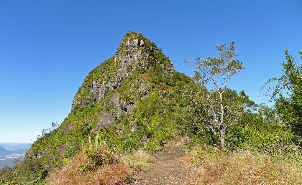
The Cotswold track to the summit of Mt Maroon begins at the end of the Cotswold unsealed road, crosses private property through a gate that leads up a small hill. After passing a few dams you continue up the ridge as it gradually becomes steeper. A track follows the steep eastern ridge-line so that you are continually gaining elevation. Eventually you come across Egg Rock that juts out over the valley below offering unhindered views to the North and East. The track then begins to flatten out and descends briefly as the imposing 200 meter North East face comes into view well know for its climbing routes in particular the Ruby of India.
As you pass the impressive North East cliff face the track ascends very steeply up a prominent gully that requires some scrambling. As you up the gully it tapers off into thick scrub. You then follow the winding track for 100 meters until a small seasonal creek is reached, which is a traditional camp site.
From this point there is a worthwhile lookout point to venture up to before crossing some rocky slabs that require a short scramble up to the summit of the South Peak and 360 degree unhindered views of the scenic rim and beyond.
I had days off work over Easter so I headed down to Mt Warning and the over to Spring Creek Mountain. On the first day I climbed to the summit of Mt Warning which was about a four hour return hike. The views at the summit were pretty special with the clouds floating by beneath you. Unfortunately, my camera doesn't do the views justice. The climb up to to summit is not difficult, only the last 200 meters is a bit hairy as it is near vertical rock face that hasoccasional rough ledges into for footholds and a chain wire rail have been installed to assist in hauling yourself up.
After that I drove over to Spring Creek Mountain and camped there for the night. I arrived late so I had to set up my tent mostly by the light of my head lamp. Next morning I walked to Browns, Dagar and Spring Creek Falls, then had lunch at the Spring Creek Mountain cafe. The NSW Jaguar club arrived while I was having lunch in E Type, Mark 11's and various other Jag models. They were telling me the old cars had a lot of difficulty getting up the Head Road with over heating and gear selection problems. Two cars had broken down on the climb up the Head Road. After lunch which included home made lemonade, the best cold drink I have ever tasted in my life and tasting nothing like store bought lemonade, I headed home via Boonah and Kalbar.
An aborted attempt on the summit of Avalanche Peak Arthurs Pass New Zealand. This walk was part of my 2009 NZ trip. Overnight heavy snow falls had carpeted the mountains surrounding Arthus Pass in a white blanket. After checking with the DOC office who said that the climb would be safe to attempt today but there would be thigh deep snow towards the summit of Avalance Peak. However, they mentioned that a group has headed out earlier so they may have post-holed a route for me.
In short the views from the climb was stunning. The snow was melting rapidly on the lower slopes but above the tree line it was still reasonably thick on the ground. Concerned about the last section short steep section onto the summit I turned back at that point, slightly disappointed in failing to reach the summit but not by the extensive views which would not been that much better had I reached the summit.
I will be back to try this climb again sometime. I hope it is after another snow fall as a blanket of snow makes the views that much more special.